Jean Baptiste Louis Clouet (1729 – 1790)
was a French geographer and cartographer born in Rennes, active in the mid to late 18th century. He had offices in Paris and Cadiz and was eventually named „Royal Geographer of the „Academie des Sciences de Rouen“. Although he made several lavish wall maps to decorate the houses of Paris and more unusually Spain, he is best known for the atlas „Geographie Moderne“, published in various editions from 1776 to 1793 which contained distinctive double page maps flanked by a column of text commentary on either side.
Map details
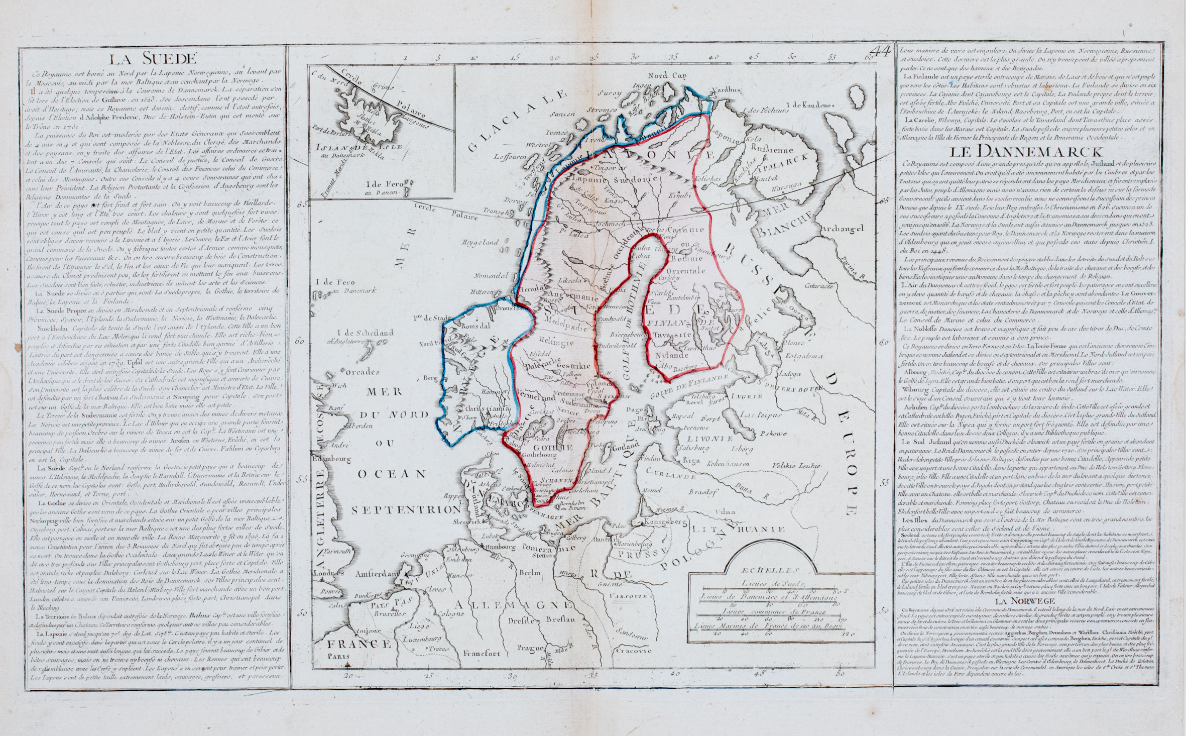
This map from „Geographie Moderne“ has no title cartouche. It is in the same style as the maps by Brion de la Tour and Desnos (No. 86 and 132), with columns on either side but the maps themselves are completely different.
The map shows the eastern part of the Faroe Islands, the Shetland and Orkney Islands, Scotland and England. Its main focus is on Scandinavia, the Baltic region, „Russie D‘Europe“, Poland („Pologne“), Pomeranie and the northern parts of Germany („Allemagne“) and France, with an inset map of Iceland and the Faroe Islands in the upper left corner. In the lower right corner four distance scales („Echelles“) are placed.
„Islande Isle au Danemark“ (Iceland in Denmark) is written underneath the map which has only very few names along the coastline and only three in the interior of the island: the bishoprics Skalholt („Skolhet“) and Holar („Hola“), both without church symbols and „M Hekla“, highlighted as volcano. The Arctic Circle („Cercle Polaire“) is marked nearly to perfection, only a bit too south. The first Meridian („Premier Meridi“) runs right through the middle of the country.
The French text in the columns on either side contains geographical information about the area.


