
Allain Manesson Mallet (1630 – 1706)
was a French well travelled military engineer, mathematician and cartographer. He made a career in the army of King Louis XIV who appointed him „Maitre de Mathematiques“. His main work is the five-volume cosmography „Description de l‘Univers“, published in 1683 which describes the landscapes, villages, ports and people with their habits and traditions in the regions of the known world. The atlas also contains numerous maps, including a map of Iceland and this map of the North Atlantic. Two years later Mallet published the German edition titled „Beschreibung des gantzen Welt-Kreysses“ which also comprises a map of Iceland.
Map details
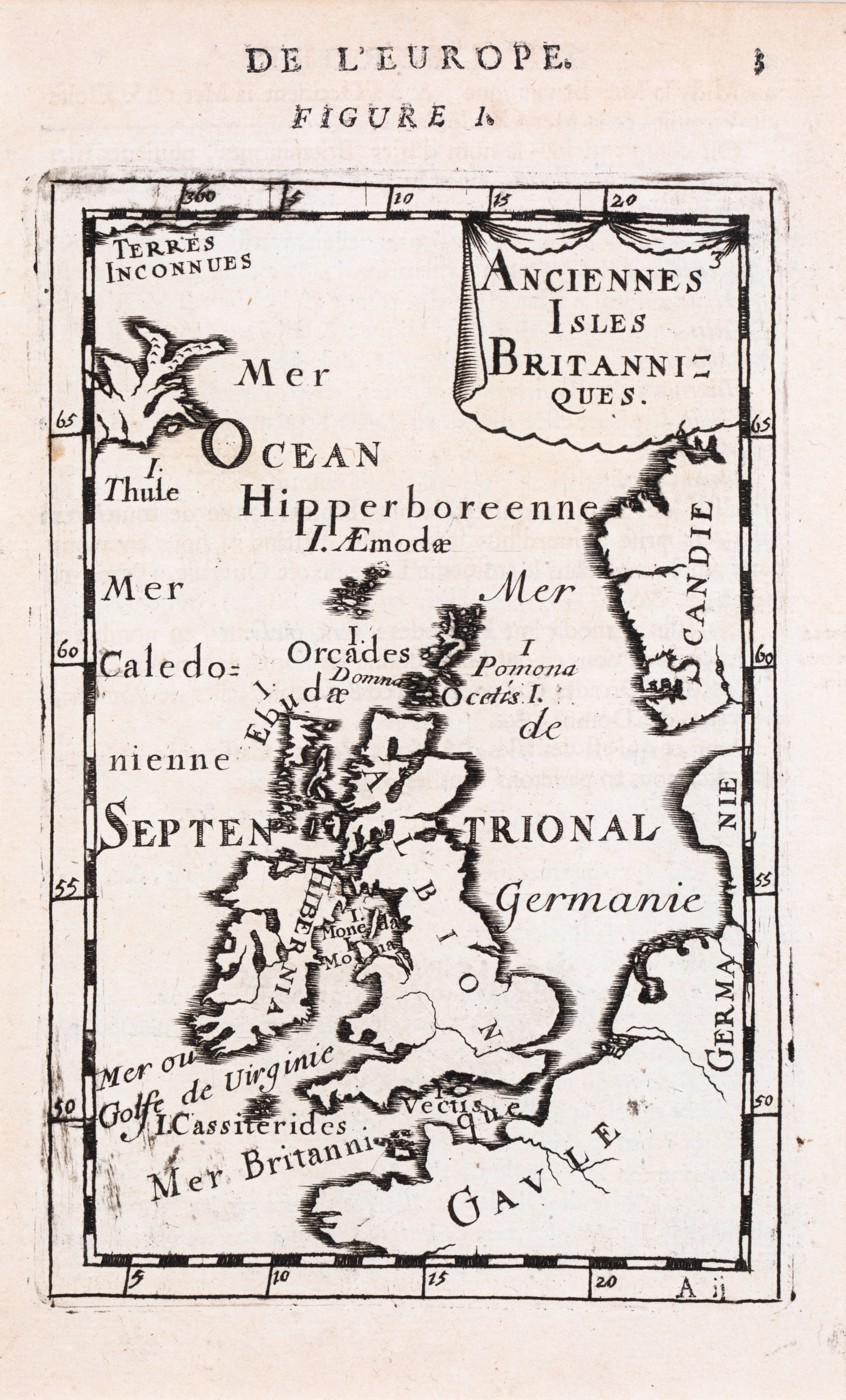
This map from the first edition shows the British Isles with the coasts of France („Gavle“), Germany („Germanie“) and Norway („Scandie“). In the Northwest an island there is an island which has the shape of Iceland but without names, symbols and the western part. It bears the name „Thule“, the legendary island described by the Greek Pytheas in the 4th century BC.