
Robert Wilkinson (1768 – 1825)
was an English map maker and book publisher in London. He was primarily a compiler of information from other sources. Most of his maps were derived from John Bowles who died in 1779 and from whom he took over the plate library. His major cartographic work is „A General Atlas, being a Collection of Maps of the World and Quarters, the Principal Empires, and Kingdoms Ec. With their several Provinces, & other Subdivisions, Correctly Delineated“ published in London in 1794 by Robert Wilkinson of No. 58 Cornhill. Wilkinson continued in business until the end of his life.
The „General Atlas“ was reissued several times until Wikinson‘s death in 1825. Afterwards the business and map plates were acquired by William Darton Jr, who re-issued the „General Atlas“.
Map details
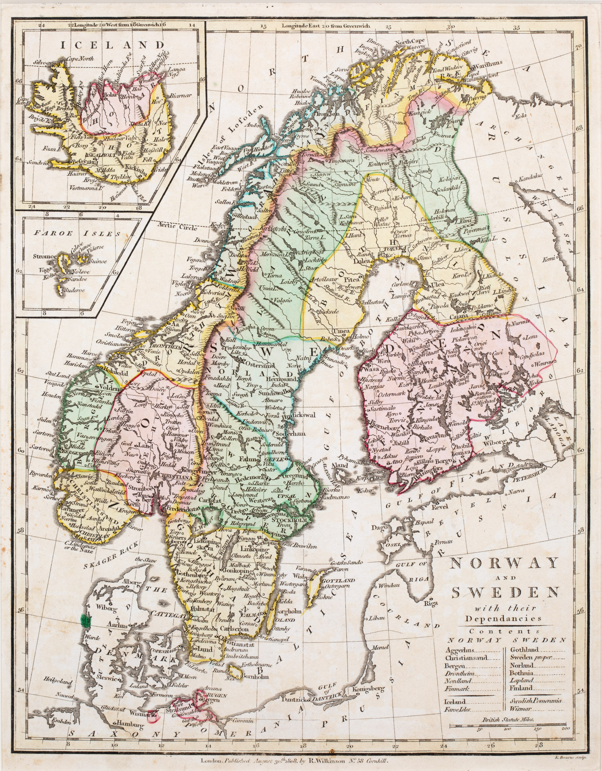
This map is from the 1808 edition of the „General Atlas“. Wilkinson‘s name and shop location and the name of the engraver Ebenezer Bourne are written underneath the neatline.
In the lower right corner the title is placed, with an additional information on the content of the map and a mileage scale but without any decoration. The map shows Scandinavia, the western part of „Russia“, „Prussia“, „Pomerania“ and „Saxony“, including Iceland and the Faroe Isles in two separate insets in the upper left corner.
While the main part of the map is very similar to Wilkinson‘s map of 1794 (No. 164) the content of the inset „Iceland“ is very different. The map is no longer dominated by long mountain ranges but by the bisection (in contrasting colours) into the districts named „Skalholt“ and „Holar“, the two bishoprics. The villages themselves are printed without church symbols. Mt. Hekla is depicted as a very small volcano.
The Arctic Circle is marked in the main map and also in the inset but runs too far south. In reality it crosses Grimsey and not the western fjords but the island is missing on the map.