
Alexandre Blondeau (active from c 1799 to 1828)
was a French engraver based in Paris. In 1816 during the reign of Louis XVIII, he was appointed „Graveur du Roi“ and „Premier Graveur du Depot de la Guerre“. Nothing more is known about his life.
Map details
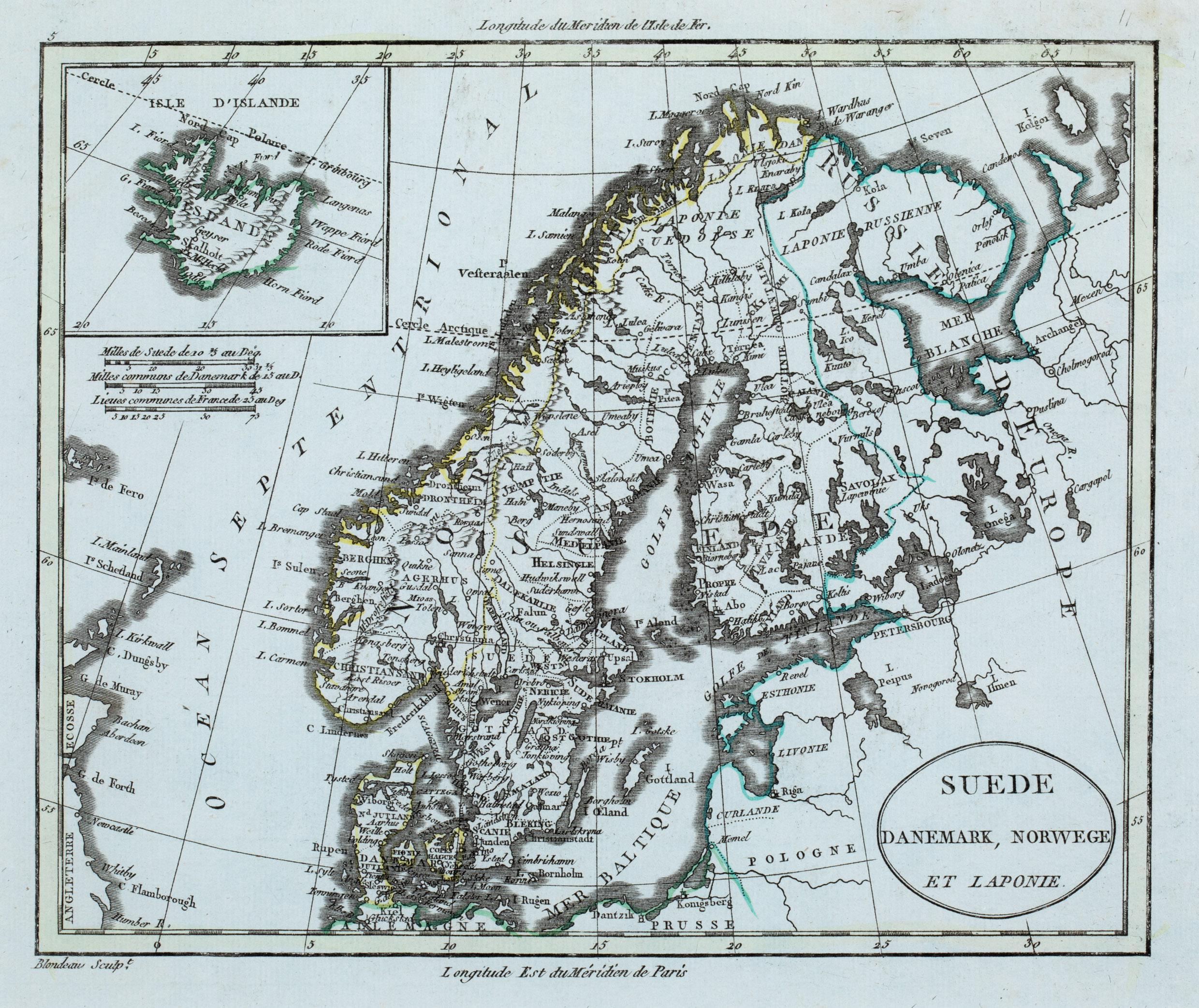
Blondeau‘s name appears underneath the neatline of this map which was published by William Guthrie in the „Atlas Universal pour la Geographie de Guthrie“ in 1796.
The title is to be found in an oval cartouche in the lower right corner. The map shows Scandinavia, the Baltic region, „Russie D‘ Europe“, Poland („Pologne“), Prussia (Prusse“), the northern part of Germany („Allemagne“), the east coast of England („Angleterre“) and Scotland („Ecosse“), the Orkney („Kirkwall“). the Shetland Islands (Is Schetland“) and the Faroe Islands („Is de Fero“). The Arctic Circle is marked nearly correctly, also in Iceland which is to be found in a rectangular inset in the upper left corner.
„Islande“ is written across the country which is characterized by mountain ranges. There are few place-names along the coast line and only four in the interior: the bishoprics Skalholt and Holar („Hola“) without church symbols, „Geiser“ and „Mt. Heckla“, not highlighted as a volcano.
Below the inset three distance scales are placed.