Robert Dudley (1573 – 1649)
was the illegitimate son of the Earl of Leicester, a favourite of Queen Elizabeth I (the Virgin Queen) and Lady Douglas Sheffield. His father was a supporter of explanatory expeditions and backed Francis Drake on his circumnavigation (1577-1580) and Martin Frobisher on his 1576 voyage to find the Northwest Passage. Well educated, Robert Dudley was interested in naval matters from an early stage, and in 1594, at the age of 21, he joined the Elizabethan maritime adventurers and led an expedition to the Orinoco River, raiding Trinidad en route. After the death of his father who gave him a sizeable inheritance he thought the time was right to establish his legitimacy. In court proceedings he fought for his right to his father’s titles and failed. Therefore he left England for self-exile in Italy in 1605 and worked as a noted shipbuilder. He styled himself „Earl of Warwick and Leicester“, as well as „Duke of Northumberland“ in 1620, which caused James I to seize all Dudley’s English Properties. In the years 1646-47 in Florence, he published a large collection of spectacular sea charts which he called „Dell‘Arcano del Mare“ (Mystery of the Sea).
The atlas is regarded as one of the greatest atlases of the world and of utmost importance in many respects. It was
– the first sea-atlas to treat the entire world;
– the first atlas to utilize the Mercator Projection on a uniform basis;
– the earliest to show magnetic deviation;
– the first to show currents and prevailing wind;
– the first to expound the advantages of „ Great Circle Navigation“, sailing the shortest distance between two points on a globe.
As a marginal note: the first sea-atlas to be compiled by an Englishman (albeit engraved and published in Italy).
Robert Dudley received information from his friends Francis Drake and Thomas Cavendish and he used original charts of Henry Hudson. The engraver was Antonio Francesco Lucini (mentioned in the lower right corner). It took him fourty years to prepare and twelve years to work on the copper plates, which weighed 5000 lbs.
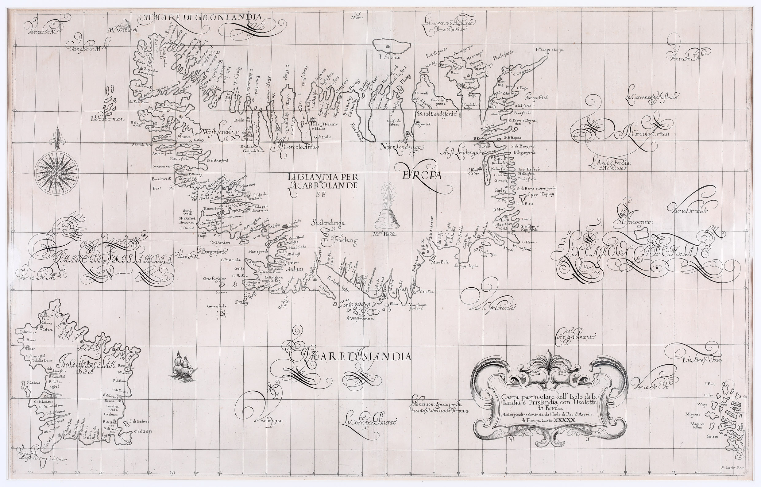
Map details
This spectacular sea-chart, in beautifully engraved detail, depicts Iceland and includes to the eastern part of the Faroe Islands and some phantom islands:
– to the south west „L‘Isola da Frislandia“
– to the east „I: Incognita“
– to the north west „I: Gouberman“.
The fictitious island of Frisland which often appears on maps of the time is presented in great detail, containing over 50 names. Obviously Dudley repeats names again and again in an effort to embellish his sea-chart.
This rare map is very decorative, not least because of the large cartouche in the lower right corner and the strange squiggle typography which is supposed to be Italian Baroque art. It is embellished by a sailing vessel and a large compass rose but rhumb lines and a distance scale are missing. The Arctic Circle is marked to far south.
The map of Iceland is depicted in the Joris Carolus style. As it is a sea-chart, the map concentrates on the coasts along which numerous place-names are to found. The interior of the country is nearly empty, only enlivened by the famous volcano Hekla erupting.
Comments by the collector
This sea-chart was offered by the „Map House“ in London in the early eighties. The price was rather high in relation to the income and wealth of my wife Gisela and myself as young academics. To make it possible I had to sell my (nearly complete) collection of stamps of the Federal Republic of Germany. My father-in-law, a passionate stamp collector, was not amused but some time later he forgave me.


