Charles Picquet (1771 – 1827)
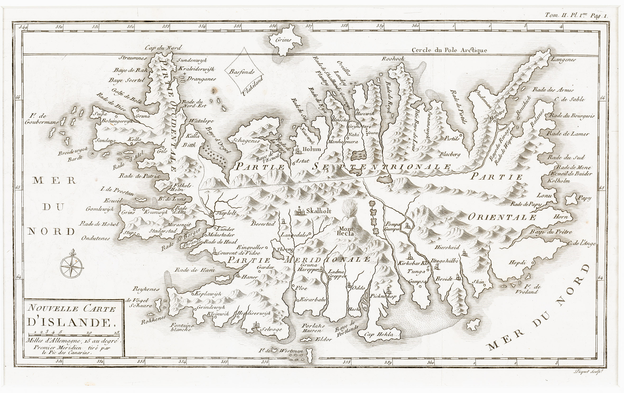
was a French cartographer active in Paris in the late 18th and early 19th century. From about 1798 he supplied maps to the Depot de la Guerre. From 1806 he was appointed to Napoleon‘s „Cabinet Topographique“. Being politically dexterous he managed to retain his position after the fall of Napoleon under both Louis XVIII and Charles X. He worked together with the cartographer Adrien-Hubert Brue (1786- 1832), one of the most important French cartographers at the time, and became famous by completing Brue‘s „Atlas Universel“ of 1822. Picquet also engraved the maps in the work „Histoire des Peches, Des Descouvertes Et Des Etablissemens Des Hollandois Dans Les Mers Du Nord“ (Volume 2) by Bernard de Reste from 1801.
Map details
This very rare map from „Histoire des Peches“ has a title cartouche in the lower left corner including a distance scale, with a wind rose above. Iceland is divided into four sectors: in the North „Partie Septentrionale“, in the South „Partie Meridionale“, in the West „Partie Occidentale“ and in the East „Partie Orientale“. The map is rather detailed showing many mountain ranges, fjords, lakes and a few settlements, amongst them the bishoprics Skalholt and Holar („Holum“). Hekla („Mont Hecla“) is erupting in a fiery explosion. The Arctic Circle („Cercle du Pole Arctique“) is nearly placed correctly, with the southernmost tip of Grimsey („Grims“) touching it but the northernmost tips of the Westfjord („Cap du Nord“) and of the Eastfjord (near Langenes) are further south.
In the Arctic Ocean between the Westfjords and Grimsey there is s strange rectangular to be seen named „Basfjonds Ulakiland“ (?).


