
James Barlow (1759/60 – 1810 or later)
was a British engraver active at the turn of the 19th century working in London. The only information about him and his company is to be found at britishmuseum.org/collection. „Individual; printmaker; British; Male“ and his life dates above. His company was registered as follows: „John Barlow/Engraver /No 39/New George Street/Blackfriars Road“. „Although his name appears primarily on platesin periodicals he was obviously running a profitable business“. Nothing more is known about his life.
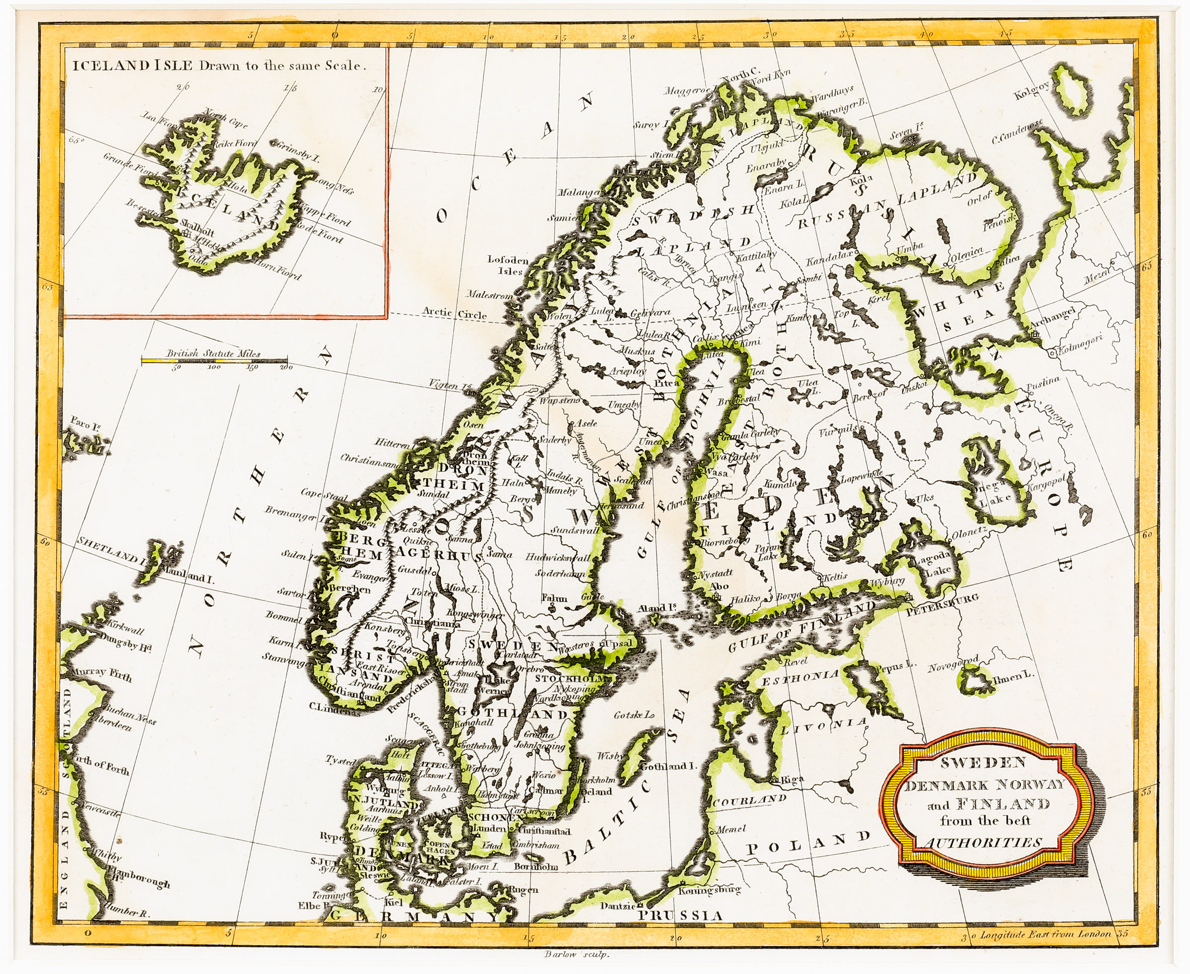
Map details
This map was based on maps produced by Thomas Kitchin in the later half of the 18th century. It was published in „A General View of the World: Geographical, Physical and Historical; on a Plan Entirely New“ by C. Brightly & T. Kinnersley Publishers, Bungay, Suffolk). The map is very similar to another map of Barlow (No. 170), the size and the year are the same but the cartouche in the lower right corner is completely different and there are other slight differences.
On this map the title is written in a hatched and shaded frame in the lower right corner of the map and the author’s name below the frame: „Barlow sculp.“ The map depicts Scandinavia, the Baltic region, „Russia in Europe“, Poland, the northern part of Germany and Prussia, the the eastern part of the Faroe Islands, the Orkney and Shetland Islands and the eastern part of Scotland and England.
In the upper left corner is a rectangular inset map of Iceland. The text above says: „Iceland Isle Drawn to the same Scale“. Underneath a distance scale is placed.
Along the coastline of Iceland there are several place names of fjords and villages, in the interior only three: the bishoprics Skalholt (with a church symbol) and Holar („Hola“) and „M‘t Hekla“.
The Arctic Circle is marked in the main part of the map but not in Iceland.