
Daniel de la Feuille (1640 – 1709)
was born of Huguenot stock in Sedan, France. As a young man he apprenticed as a watchmaker. In 1683, facing religious prosecution of Huguenots in France, he fled with his family to Amsterdam. By 1686 Daniel had become a „poorter“ (citizen) of the city and established himself as an engraver, bookseller and dealer. In 1691, he was admitted into the Booksellers Guild. His masterpiece is considered to be „Devises and emblemes“, a collection of symbols and designs; most of them have the shape and size of a watch which made them especially useful for watchmakers and other craftsmen.
During his life, Daniel published about twenty books and commemorative poems. His cartographic work includes numerous individual maps and atlases, many of which were republished well after his death by his sons Jacob and Paul.
Map details
This map was published in his „Atlas Portatif, Ou Le Theatre De La Guerre En Europe“.
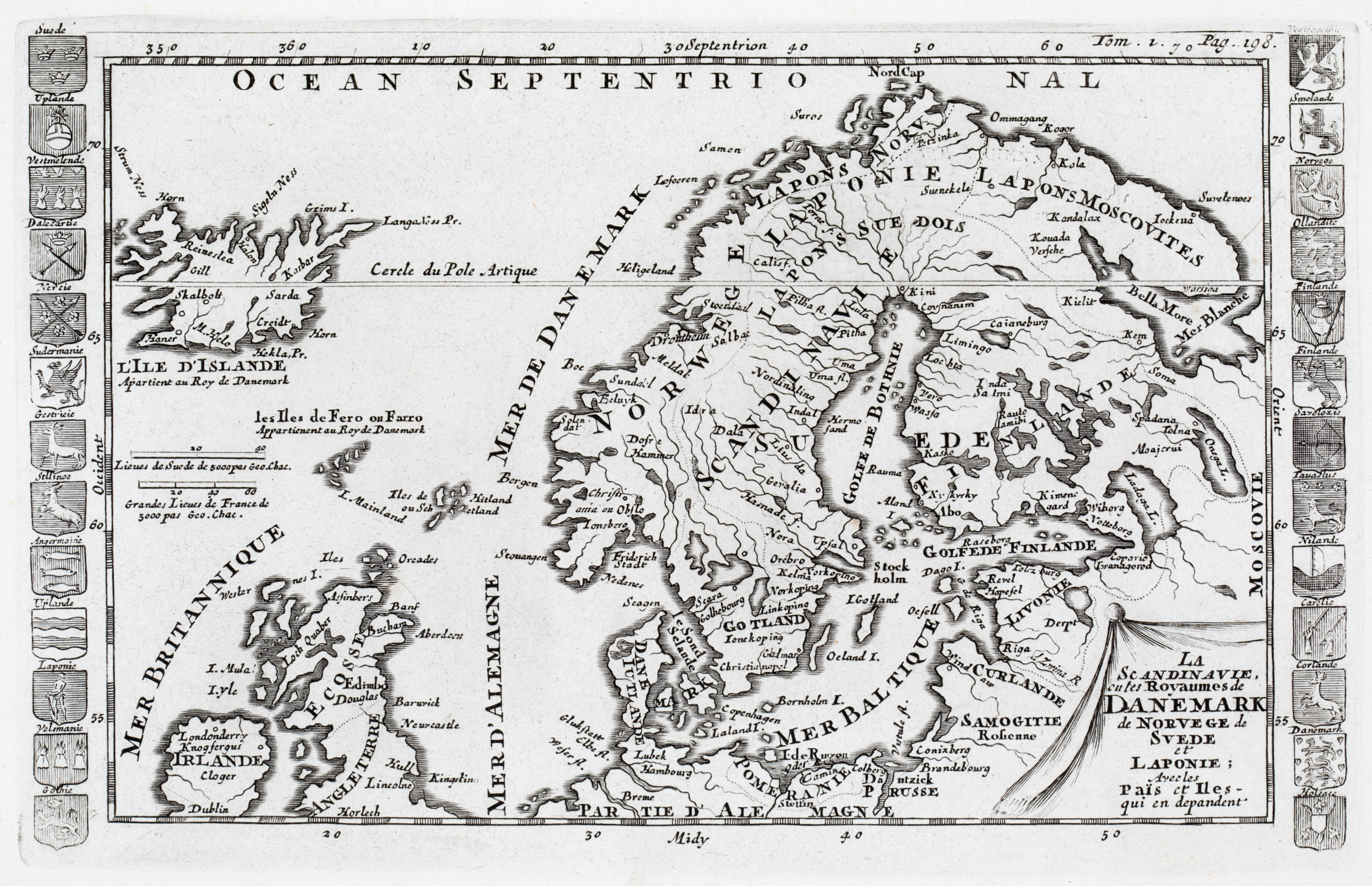
It is decorated with an unusually shaped title cartouche in the lower right corner. „L‘Ile D‘Islande“ is drawn to scale in the upper left corner, together with the notice underneath: „Apertient au Roy de Danemark“ (Property of the King of Denmark). In the North Atlantic two distance scales are depicted. Ornamental embles of countries and regions are flanking the map.
The map covers Scandinavia, Iceland, the Faroe, Shetland and Orkney Islands, Ireland, Scotland, most of England, the Baltic region, Prussia („Prusse“), „Pomeranie“ and the northern part of Germany („Partie d‘Alemagne“). „Moscovie“ is written vertical at the right hand side of the map.
Along the coastline of Iceland and also in the interior there are only very few place names, amongst them the bishoprics Skalholt and Holar („Halon“) and „M. Hecla“. A main error is the positioning of the Arctic Circle („Cercle du Pole Artique“) which is placed in the center of Iceland.
In the „Schulte Collection“ there are four maps (No. 100, 111, 144 and 152) which look quite similar but mainly languages, frame decorations and publication years differ.
This map of Daniel de Feuille (No. 144) is in French language as the one of Elias Baeck (No. 152); the maps of Claude Buffier (No. 111) and the anonymous map (No. 100) are in Italian.
Three maps are flanked with coats of arms but these are omitted in the map of Claude Buffier (No. 111). Additionally Baeck‘s map (No. 152) is embellished with a long serpentine strap headlining the map. These variations lead to slightly different sizes of the maps.
This map of Daniel de la Feuille (No. 144) is the earliest map (1702) of those four, the map of Elias Baeck (No. 152) and the anonymous map (No. 100) have both been published around 1720 and the youngest map is the one by Claude Buffier (No. 111) of 1790.