
Johann Justinus Gebauer (1710 – 1772)
was born in Waltershausen and learnt the book printing and trade business. In 1732 he took over a book-printing company in Halle. Gebauer published around 500 works not only in German but also in Latin, Polish, Bohemian (Czech), Wendish and Hungarian language. His greatest historical work is the publication „An universal history from the earliest account of time tho the present“ which was first edited „in England durch eine Gesellschaft von Gelehrten“ (in England by a society of scholars) in the year 1730 and translated in several languages.
The „Allgemeine Welthistorie“ was indispensable part of the libraries of scholars in the Age of Enlightment.
Map details
This very rare map is taken from the „Fortsetzung der Allgemeinen Welthistorie“ (Continuation of the Universal History), published between 1750 and 1780 approximately.
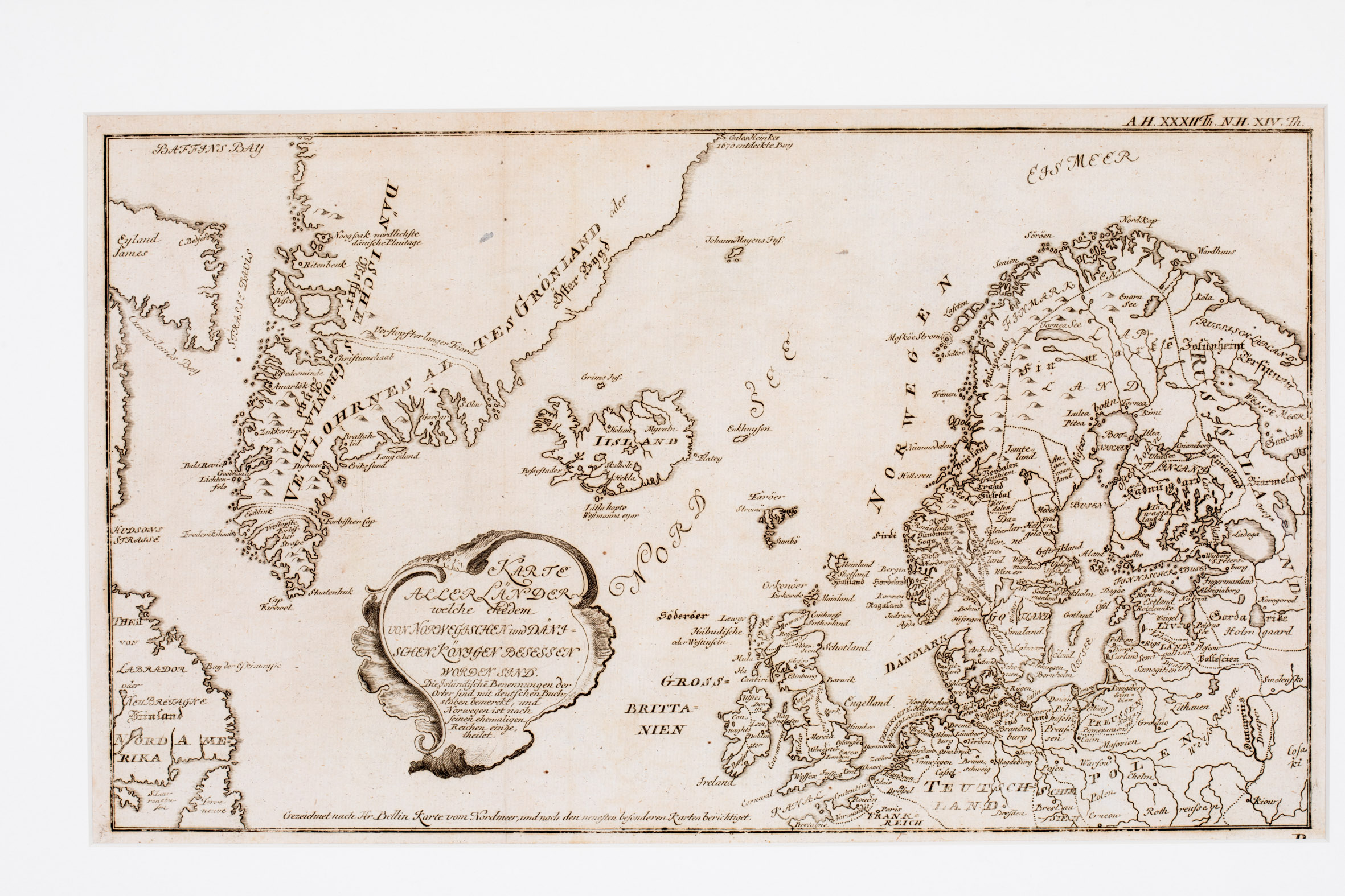
The map is embellished by an unusually shaped title cartouche placed in the North Sea and shows the Baffin Island („Eyland James“) near Davis Street, „Nordamerika“ including Labrador and Newfoundland, Greenland, Iceland, the mysterious „Enkhuysen“ island, Jan Mayen („Johann Mayens Ins.“), the Faroe, Shetland and Orkney Islands, Great Britain („Grossbrittanien“), Scandinavia, the Baltic region, Poland („Polen“) and the northern parts of Germany („Teutschland“) and France („Frankreich“).
The presentation of Greenland is rather odd. On the one hand it is depicted as four islands, separated by channels which are categorized as „verstopft“ (clogged), on the other hand it consists of two parts: the land along the eastern coastline is named „Verlohrnes altes Grönland“ (Lost old Greenland) and along the western coastline „Dänische Grönland“ (Danish Greenland).
„Iisland“ is written across the island; the capital letter „I“ probably stands for „island“. Information is very poor. There are only eight place-names, only four in the interior: the bishoprics Skalholt and Holar („Holum“), the volcano Hekla (all not hightlighted) and lake Myvatn. The Arctic Circle is not drawn on the whole map.
Comments by the collector
In islandskort.is this map is listed and Jacques Nicolas Bellin is named as the mapmaker but at the bottom of the map an important information from the author can be found: „Gezeichnet nach Hr. Bellin Karte vom Nordmeer, und nach den neuesten besonderen Karten berichtigt.“ (Drawn after Mr. Bellin Map of the North Sea, and corrected after the most recent special maps.)