
Jean Baptiste Bourguignon D‘Anville (1697 – 1782)
was a French geographer and cartographer who greatly improved the standards of mapmaking. Born in Paris as son of a tailor, his passion for geographical research displayed itself from early years. He is said to have designed his first map at the age of fifteen. Jean Baptiste Bourgignon D’Anville continued the line of progressive French cartographers in the tradition of Guillaume Delisle and Nicolas Sanson in the previous century. In the age of only 22 he became one of the „geographes ordinaire de roi“ (cartographer to the King)in 1773. While in the service of the crown he tutored the young Louis XV. During his lifetime he made 211 maps which are characterized by an accurate work, largely based on original research. D‘Anville disapproved of merely copying features from other maps. In particular, he left unknown areas blank and rejected names which were not supported by other sources.
His first important work was the large map of China, prepared for the surveys of the Jesuits, first issued in 1735. His „Atlas General“ from 1743 went through numerous expanding editions in various languages until 1780. His map of Africa (1749) was used well into the nineteenth century.
D’Anville’s maps remained the reference point in cartography throughout the 19th century and were used by numerous explorers and travellers. His library of more than ten thousand maps was acquired by the Royal Library of Paris (now Bibliotheque nationale de France).
Map details
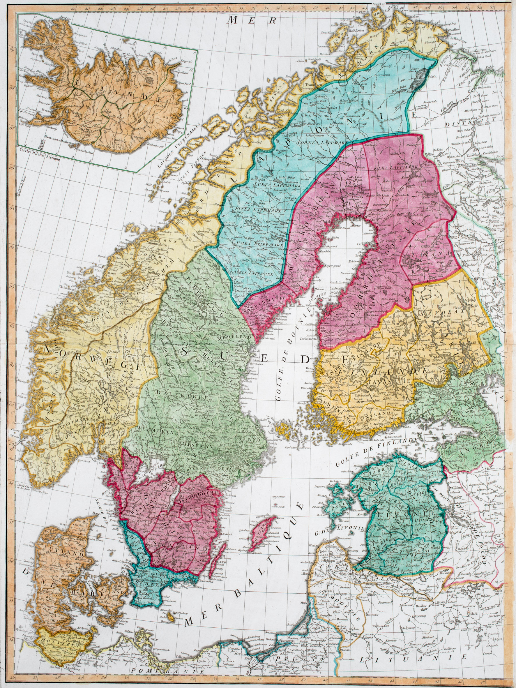
This rare map from the „Atlas General“, engraved by Guillaume de la Haye, Paris, shows Scandinavia, the Baltic region, Prussia („Prusse“) and Pomerania („Pomeranie“). The inset map of Iceland is placed in an unusual frame in the upper left corner. The map is extremely accurate.
Along the coastline and in the interior of Iceland numerous mountain ranges, rivers, lakes and fjords are depicted. Amongst the place names are four glaciers („Iokul“) and the bishoprics Skalholt and Holar („Hola“), both with church symbols, and Hekla (not hightlighted).
The Arctic Circle („Cercle Polaire Arctique“) is drawn in the main part of the map. It is probably marked by a line drawn through the middle of Iceland but it is much too far south.