
Richard Gridley (1710 – 1796)
born in Boston, Massachusetts as the youngest of 12 children. As a young man he was apprenticed to a Boston merchant. Later he became a surveyor and a civil engineer, as well as the chief architect of Boston‘s Long Wharf. Then he became an American military officer who served for the British Army during the French and Indian Wars and in the American Revolutionary War as Chief Engineer (artillery) for the Continental Army under George Washington‘s command. Along with Osgood Carleton, one of the most active American mapmakers of the post-Revolutionary period, Richard Gridley was one of the few Americans trained in military engineering and mapmaking.
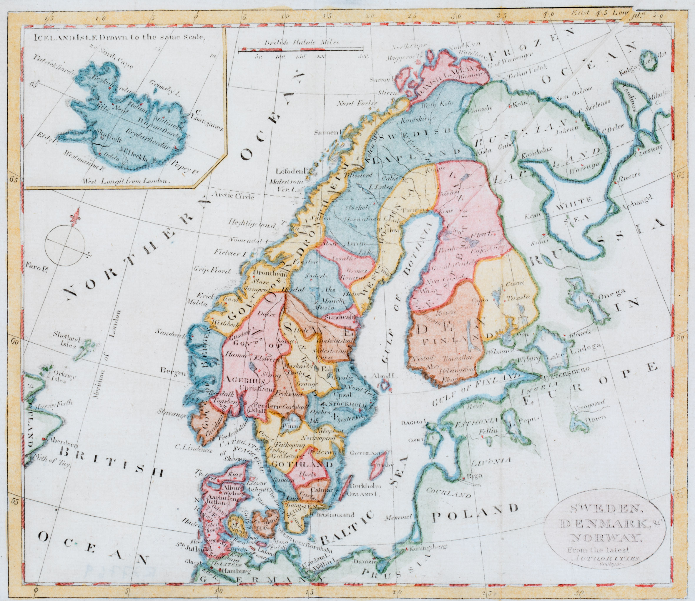
Map details
This map has an oval title cartouche in the lower right corner (with the name of the author) and shows the Faroe Islands (only the name), the Shetland and Orkney Islands, the east coast of Scotland, Scandinavia, the Baltic region, „Russia in Europe“, Poland and the northern part of Prussia and Germany, including an inset map of Iceland in a pentagonal frame in the upper left corner. Underneath the map a compass rose and in the upper center a distance scale are placed.
„Iceland Drawn to the same Scale“ is written on top of the map. There are only very few place names to be found along the coastline and in the interior of the island. The bishoprics Skalholt and Holar („Holum“) are named, the first with a church symbol. „Mt Heckla“ is not depicted as a volcano.
The Arctic Circle is drawn in the main part of the map. It is probably marked by a line drawn through the middle of Iceland but it is much too far south.
COMMENTS BY THE ANTIQUARIAN
As I could not find anything about Gridley as a publisher I asked chat.openai.com the question:
„There is an old map on Scandinavia by Gridley in 1788. Do you know more?“
The answer came at once. „Richard Gridley did indeed publish a map of Scandinavia in 1788… It is considered to be a relatively rare and important map of the region from the late 18th century. It reflects the growing interest in geography and cartography in the United States during this period, and the increasing sophistication of American Mapmaking“.
I asked again: „Superb. Do you know the life dates of Gridley?“ The answer was: „Yes, Richard Gridley was born on January 3, 1710, in Boston, Massachusetts, and he died on June 21, 1796, in Stoughton, Massachusetts. Therefore, he lived to be 86 years old.