
John Russell (c. 1750 – 1829)
was a British cartographer active in London. He apprenticed as a goldsmith before he turned to engraving and printing. John Russell employed the use of advanced surveying techniques and drew and engraved maps for several major publishers of his period including William Guthrie (see No. 95). His maps were highly regarded for their precision, attention for detail and artistic quality. His work primarily focused on producing accurate and detailed maps of various regions, including Scandinavia and Iceland. Nothing more is known about his life.
Map details
Information about the source of this map is to be found underneath the lower neatline:
„Published as the Act directs by C. Dilly and G.G. & J. Robinson April: 1799“
As they were the publishers of William Guthrie‘s „Geographical, Historical, and Commercial Grammar“, edited first in 1790, it is likely that this map of taken from one of the numerous editions of this work.
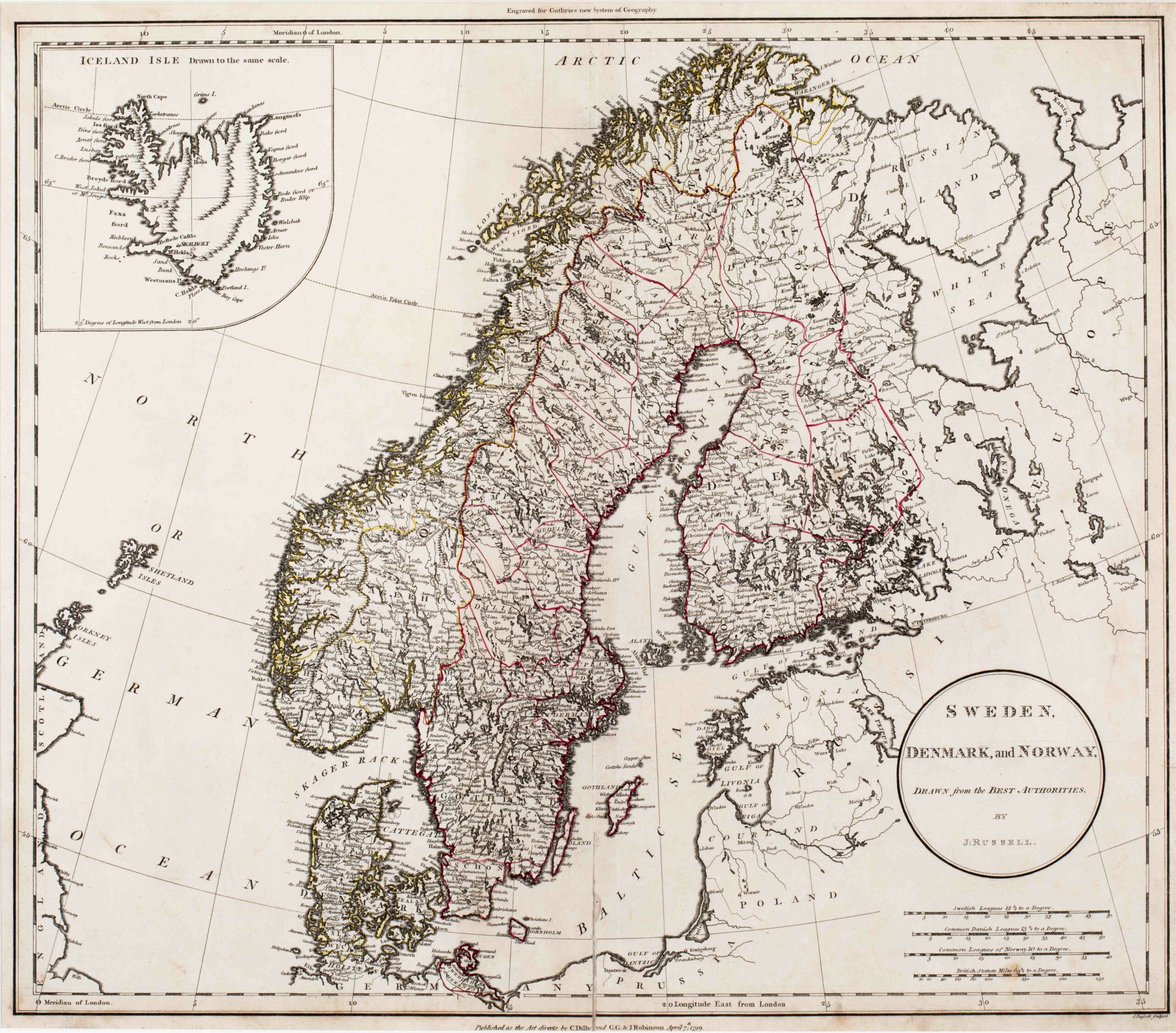
Its title is set in an oval frame in the lower right corner, also naming the author („J. Russell). Underneath are four distance scales. The map shows Scandinavia, the Baltic region, „Poland“, the northern parts of „Prussia“ and „Germany“, the Orkney and Shetland Islands and the eastern parts of Scotland and England.
In the upper left corner is an inset map of Iceland which is unusually separated by a sweeping curve. The text above says: „Iceland Isle Drawn to the same scale“.
Iceland is rather crudely drawn. In the interior of the island four long mountain ranges are to be seen. Along the coastline there many place names but only three in the interior: the bishoprics Skalholt and Holar („Hola“) with church symbols and „Mt. Hekla“ with a volcano nearby.
The Arctic Circle is drawn in the main part of the map and also in Iceland but runs too far south. In reality it crosses Grimsey.