Etienne Andre Philippe de Pretot (1710 – 1787)
was a French schoolmaster and geographer active in the middle part of the 18th century. His corpus of work includes various publications on history, cosmography and geography.
He was Professor of History and Member of both the Academies Royales des Sciences et Belles-Artes de Rouen et d’Angers. Nothing more is known about his life.
Map details
An earlier version of this map was engraved by J.E.J. Vallet for de Pretot’s „Atlas Universelle“ in which the year 1767 is stated in the cartouche; this map of 1787 is nearly identical but without date. The map is very rare and its source is mysterious. In islandskort.is there is no verified information: „The map was probably published in a map collection, Atlas universal, by the French History Professor Philippe de Pretot“.
The title of his atlas is „Universal Atlas for the study of geography and ancient and modern history“, Paris, Nyon 1787. Its folio is small (30 x 25 cm) but this map has the size 40 x 25 cm. Because these measures fit to de Pretot‘s „Cosmographie universelle, physique et astronomique“ it is more likely that this atlas is the source of the viewed map.
Underneath the lower neatline are two names: „Moithey Ing. del.“ on the left and „J. E. J. Vallet Sculp.“ on the right. The distribution of tasks was as follows: De Pretot was the publisher, Moithey the cartographer and Valet the engraver. A fourth person is mentioned in the title cartouche: „dirigee par Mr. Philippe, Conseur Royal et Professeur d‘histoire; de l‘Academie Royale de Sciences et belles-lettres d‘Angers.“
The map is drawn to scale. Outside the frame on the right, geographical coordinates and climate information are written.
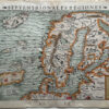
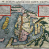
A decorative title cartouche is depicted in the lower left part of the map with the Royal coats of arms of Denmark, Norway and Sweden. The map shows Iceland and Jan Mayen in the far North, the fantasy “Isles d‘Enkhuse“, the Faroe, Shetland and Orkney Islands, Scandinavia, the Baltic region, „Russie d‘Europe“ and the German states of Prussia („Prusse“), Pomeranie, Lower Saxony („Basse Saxe“) and Holstein.
The Arctic Circle is marked all over the map but with regard to Iceland a bit too south. Unusual is a ribbon which looks like a river, flowing from the Northern Ocean to Denmark. „Kimmen ou le Borneur“ traces what is known to be the edge of the European continental shelf. A vertical line marks the first Meridian („Premier Meridien Fixe a l‘Isle“).
Along the coastline of Iceland many place names are to be found, in the interior only a few mountain ranges, „M’t Hekla“ (depicted as volcano) and four churches: Skalholt, Holar („Hola“), „Astat“ and „Kirkebor“. A dotted line marks the four districts.
COMMENT BY THE COLLECTOR
I bought this map in an auction of Stockholms Auktionsverk on 29 September. It had been announced as „PRETTY. Carte nouvelle du Dannemarck…“ from an unknown author. That day I was on Comoros, a rather unknown group of islands east of Mosambik. Not much time to think it over and and a weak Internet connection. I made the highest bid. When I wrote the description this map No. 171 I recognized that I already owned an identical map (No. 146). The only difference is the image: the first mentioned is coloured and the other not. Such a „misfortune“ can happen when a collection is big and the collector loses the overview…


