
Thomas Kitchin (1718 – 1784)
was a London based engraver, cartographer and publisher. At the age of 14, he apprenticed to the prominent mapmaker Emanuel Bowen. In 1739 Kitchin married Bowen‘s daughter Sarah and later inherited much of his preceptor‘s prosperous business. By 1741 Kitchin worked independently and about 1773 he acquired the title „Royal Hydrographer to King George III“ of England, a position his son Thomas Bowen Kitchin also later held. Thomas Kitchin is responsible for numerous maps published in „London Magazine“, „Gentleman‘s Magazine“ and „The Star“. His most important works are the first pocket atlas of Scotland „Geographia Scotiae“ in 1748/49, „The Small English Atlas“ in 1749 which he co-published with another of Bowen‘s apprentices, Thomas Jefferys and „The traveller‘s Guide through England and Wales“ in 1783.
Thomas Kitchin also engraved maps for Guthrie‘s „New geographical, historical and commercial grammar; and present state of the several kingdoms of the world“, published by Charles Dilly, G.G. and J. Robinson in London in 1790. Kitchin is said to have frequently stolen the works of other cartographers which could be the reason why he „created“ so much cartographical work.
Map details
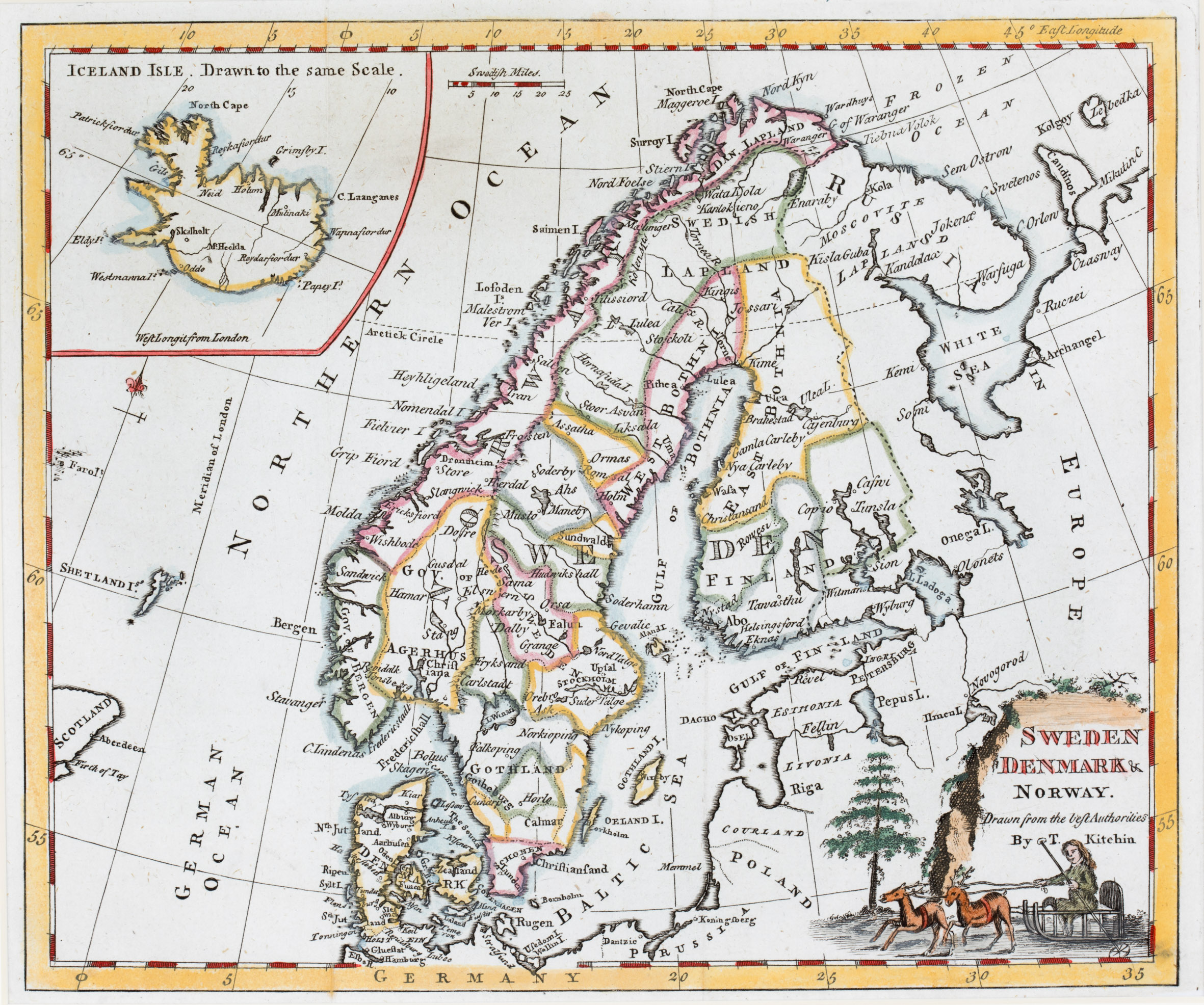
This map is taken from the 1779 edition of Guthrie’s „Grammar“. Its title is set into a beautiful cartouche in the lower right corner. It shows a big tree and two reindeers pulling a sledge with a person. This map is very similar to maps No. 110 and 94 from the same author but they have an oval frame for the title.
The map shows Scandinavia, the Baltic region, „Russia in Europe“, Poland and the northern part of Prussia, the Shetland Islands and the eastern part of Scotland and of the Faroe Islands. Germany is not depicted but written in the center of the lower part of the frame.
In the upper left corner is an inset map of Iceland which is unusually separated by a sweeping curve. The text above says „Iceland Isle Drawn to the same Scale“. On the right of the inset a mileage scale is placed.
The Arctic Circle is marked in Scandinavia but not in the inset. Along the coastline of Iceland there are several place names, in the interior of Iceland only five, amongst them Hekla („M. Heckla“) and the bishoprics Skalholt and Holar („Holum“).