
Jacques Nicolas Bellin (1703 – 1772)
was a French hydrographer, geographer and member of the intellectual group „Philosophes“. Born in Paris, at the age of 18 years, he was appointed hydrographer to the French Navy. In 1741 Bellin became the first „Ingenieur de la Marine“ of the „Depot des Cartes et Plants de la Marine“ (French Hydrographical Office“) and was named „Hydrographe Officiel du Roy de France“. During his reign the Depot published a prodigious number of maps and atlases, e.g. the „Atlas Maritime“ (1764) and the „Petit Atlas Maritime“ (1764). Bellin also contributed a number of maps to the „Histoire Generale des Voyages“ of Antoine Francois Prevost d‘Exiles“ (1697 -1763), a French author and novelist (e.g. „Manon Lescaut“), simply known as „l‘Abbe Prevost“. Prevot‘s collection was printed for the first time in 1746 and it continued until 1789, more than 20 years after his death. Many of Bellin‘s maps were copied by other map makers.
Bellin‘s work focussed on function and accuracy, tending to be less decorative than the 17th century cartographic images, thus gaining France the leading role in European cartography in the 18th century.
Map details
Obviously this is a very rare map because it is nearly impossible to find any information. According to the only source (www.islandskort.is) it is from an Italian edition of Jean Francois de la Harpe‘s collection of travel stories which was based on Prevost‘s „Histoire Generale des Voyages“.
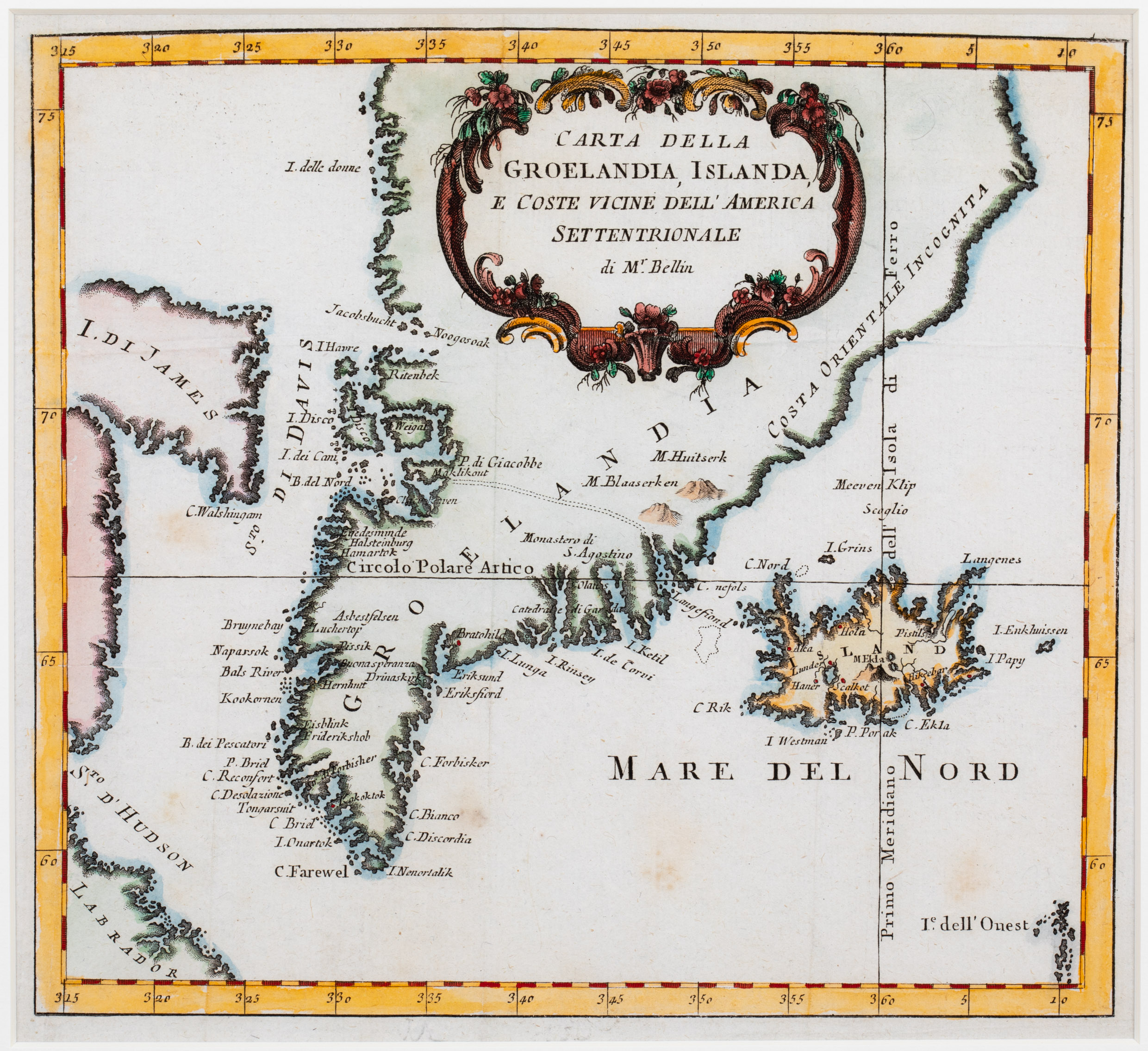
The map is centered on „Groelandia“ (Greenland), depicted with numerous place-names but unknown eastern coast („Costa Orientale Incognito“), with „Island“
(Iceland) in the Southeast and „S. Di David“ (Davis Street), „I. di James“ (Baffin Island) and „Labrador“ in the West. The title of the map is placed in a beautifully decorated cartouche in the upper center of the map.
As Bellin worked mainly in his life for French naval authorities it is not surprising that the shape of Iceland looks very similar to those Bellin normally used for his other maps.
There are only few place-names to be found along the coastline, only five in the interior, amongst them the bishoprics Skalholt (Scalkot“) and Holar („Hola“) without church symbols, but Hekla („M. Ekla“) clearly recognizable as a volcano. East of Iceland the fantasy island „I. Enkhuissen“ is depicted.
The Arctic Circle („Circolo Polare Artico“) is marked too far south.