
J.W.W. Holtrop (1751 – 1835)
was a major Dutch publisher in Amsterdam. At the time several publishers were active in the city. One of them was Steven van Esveldt (1735 – 1776) who edited a school book in 1765 which was illustrated by just eight maps. Later he produced a second set of eleven maps, amongst them a map of Denmark & Norway. After the death of van Esveldt in 1776 his widow ran the business for some time until it was taken over by her son-in-law Willem Holtrop in 1780. In the stock he changed dates and replaced names with just his surname, added some own maps and issued a new edition of van Esveldt’s school book („Geographisch hand-boekje vor de jeugd“) in 1781. After the publication of several untitled composite atlases Holtrop eventually published a pocket atlas („Zak-atlas“) with a title page and 48 maps about 1794. Beyond his publications little is known about his life.
Map details
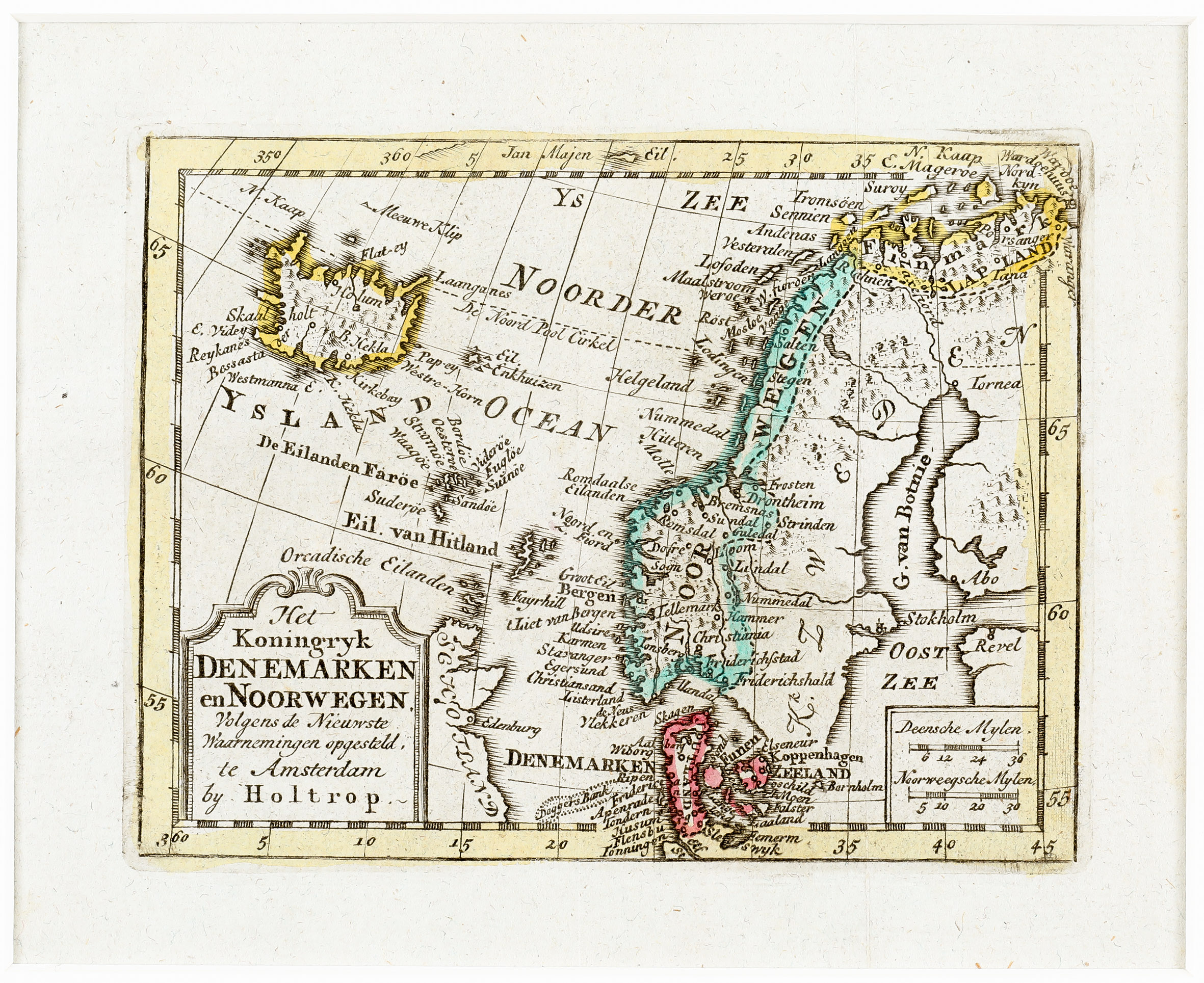
This very rare map with a nice title cartouche in the lower left corner (with Holtrop’s name) and two distance scales in the lower right corner shows Scandinavia, the Baltic, the eastern part of Scotland, the Orkney, Shetland and Faroe Islands and Iceland. The Arctic Circle runs only a bit too far south.
In the interior of Iceland there are only three place-names: the bishoprics Skalholt („Skaulholt“) and Holar („Holum“) and the volcano „Hekla“.