
Henri du Sauzet (1687 – 1754)
born in Toulouse, started 1715 to work in Amsterdam and Den Haag. He first specialised on the import of foreign books, mainly in English and French. In 1730 he took over the „Bibliotheque Francaise“ from J. F. Bernard and later he became a publisher. His main work is the „Atlas Portatif compose de CCLXXXV cartes, de plusieurs habiles geographes; ou sont representees toutes les parties de la terre“ in 1734.
Map details
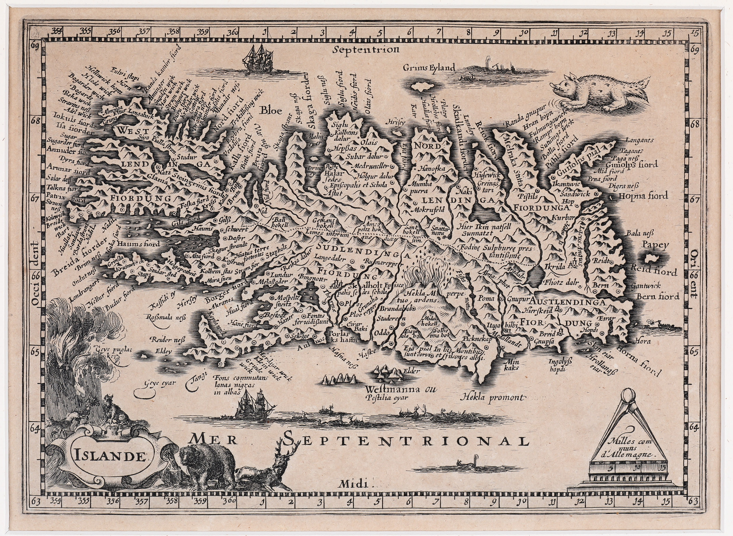
This rare map is a copy of Mercator‘s „Islandia“l „probably drawn after the original in 1595, rather than the map from Atlas Minor“ (islandskort.is).
Du Sauzet replaced the strapwork title cartouche by a large well decorated cartouche with animals in the lower left corner. Another cartouche in the opposite corner includes
a distance scale with a circle. Sailing vessels, whaling scenes and a sea monster complete the composition. The map is rather accurate and features numerous settlements, lakes, rivers, glaciers, fjords and mountains (223 (!) according to mappingiceland.is). Both bishoprics are (differently) described: „Skalholt Episcopalis Sedes Schola“ and „Halar Sedes Episcopalis Astat“. The famous volcano is shown in a fiery eruption with the text: Hekla M perpetuo ardens“ (Hekla perpetually burning).