
Giovanni Maria Cassini (1745 – 1824)
was a Rome based Italian mathematician, geographer, cartographer, engraver and globe maker. He was one of the last artists in the 18th century to engrave spheres and his globes were quite famous. His main work is the three-volume atlas „Nuovo atlante geografico universale delineato sulle ultimo osservazioni“, published between 1792 and 1801, which was the most important Italian atlas of the 18th century. Though Cassini produced a significant corpus of well-regarded work, little is known about his personal life.
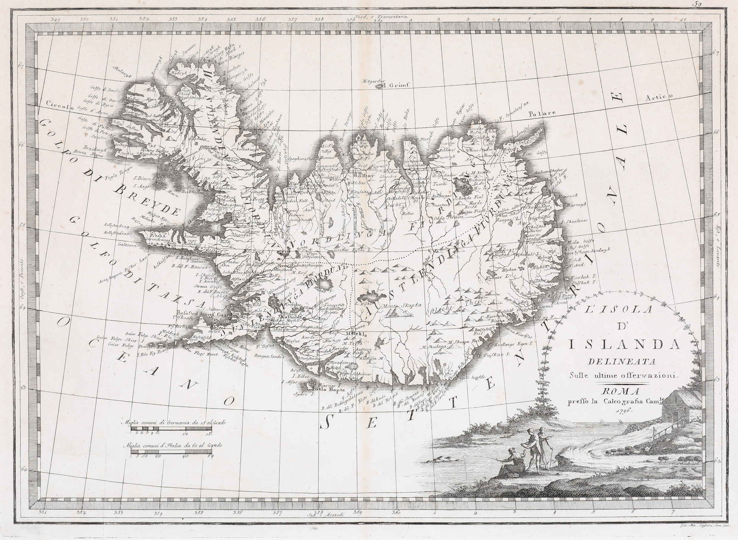
Map details
This map is based on Antonio Zatta‘s map of 1781 which again is a version of Homann Heirs‘ of 1761. Cassini‘s map appeared in the second volume of his Atlas.
The map has a decorative title cartouche in the lower right corner. Cassini replaced Zatta’s non-Icelandic scene with his own: three persons fishing in a rural scenery (still a bit Iralian). In the lower left quadrant there are two distance scales. The country is divided into four regions and shows many mountains, lakes, rivers, fjords and settlements, amongst them the bishoprics Skalholt („Skalholdt“) and Holar (Hollar“) which are named but without church symbols.The famous volcano Hekla is depicted as a normal mountain and the glaciers are not mentioned.