
John Payne (1752 – 1803)
was an American cartographer and map publisher working in New York and Philadelphia in the last years of the 18th century. He was one of the pioneers of American commercial cartography. His most important publication is „A New and Complete System of Universal Geography: Describing Asia, Africa, Europe and America; with their subdivisions of Republics, States, Empires and Kingdoms: the Extent, Boundaries, and Remarkable Appearances of Each Country; Cities, Towns, and Curiosities of Nature and Art, Also giving a … (abbr. „Payne‘s Geography“). It was printed for, and sold by John Low, a well-known publisher in New York. Nothing more is known about his life.
Map details
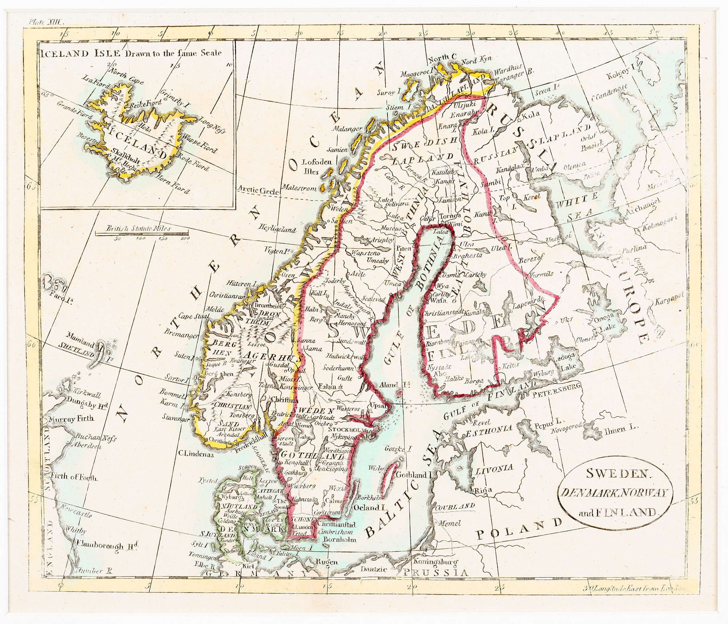
The title of this map from „Payne’s Geography“ is written into an oval frame in the lower right corner. It shows Scandinavia, the Baltic region, „Russia in Europe“, Poland, the northern part of Germany and Prussia, the Faroe, Shetland and Orkney Islands and the eastern part of Scotland and England, with an inset in the upper left corner titled „Iceland Isle Drawn to the same Scale“. Underneath the inset a mileage scale is to be seen.
The Arctic Circle is marked in Scandinavia and Russia but not in Iceland. „Iceland“ is written diagonally across the map. Along the coastline of the island several names of fjords and villages are placed. In the interior there are some strangely depicted mountain ranges and only three place names: „M‘t Hekla“ and
the bishoprics Skalholt („Skalkholt“) and Holar („Hola“).