
Franz Anton Schraembl (1751 – 1803)
was born in Vienna, where he later worked as a mapmaker and cartographer in the last quarter of the 18th century. He began his business in 1787, partnering with his fellow Austrian Franz Johann Joseph von Reilly, an art dealer and publisher. In the same year Schraembl and began his best known work in a large format, the „Allgemeiner Grosser Atlas“, which was based upon the most up-to-date cartographic information available from mainly explorers like Cook. After twenty years of compilation and composition, the work was finally finished in 1800 and became the first Austrian world atlas. Unfortunately it enjoyed only minimal circulation, possibly because of its heavy price due to its high production costs. The low sales drove Schraembl into insolvency.
His business eventually recovered with the publication of literature and art books. Upon his death in 1803, the firm was taken over by his widow, Johanna, and her brother Karl Robert Schindelmayer. From 1825 it was run by Schraembl‘s son Eduard.
Map details
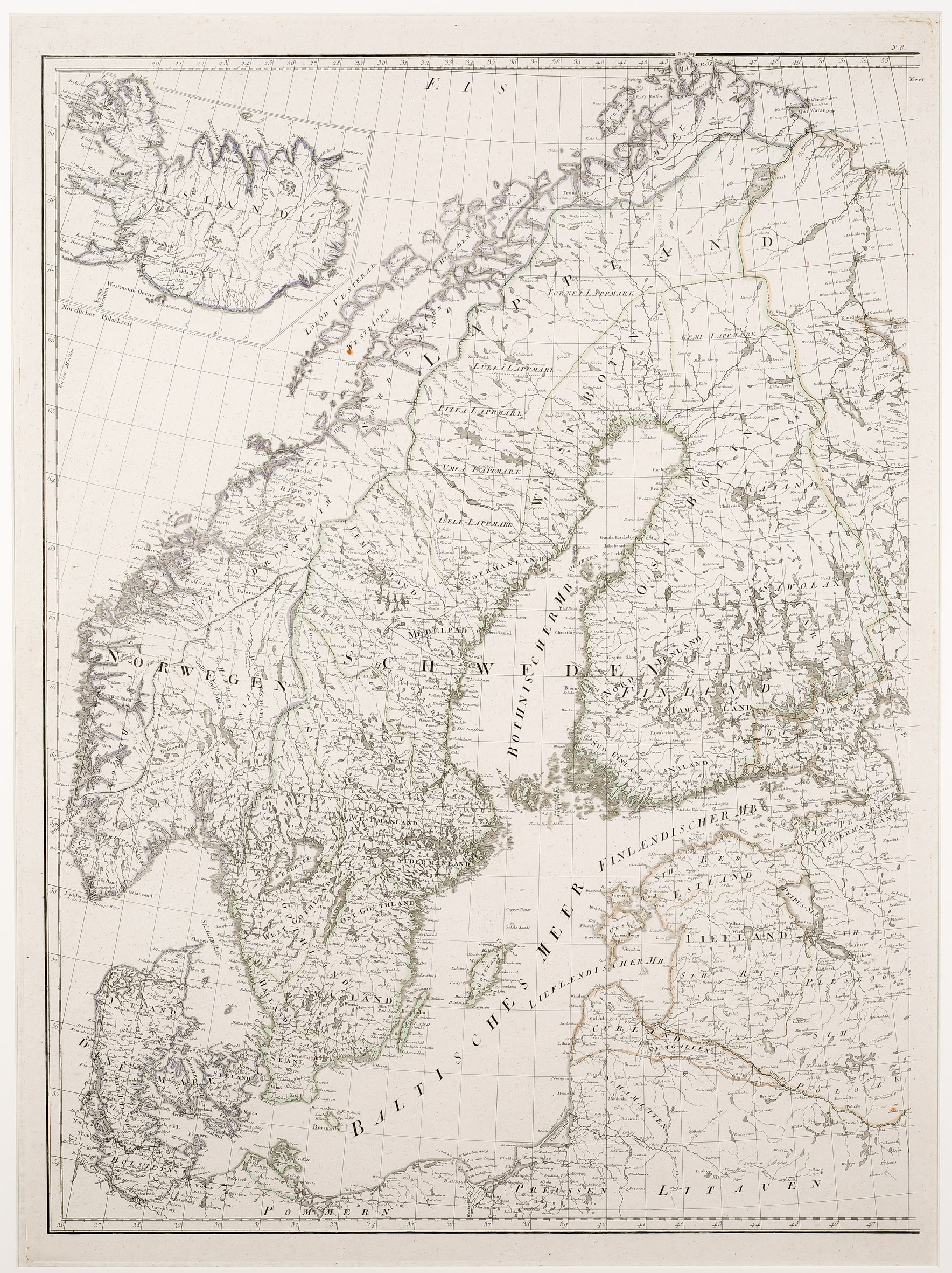
This large map was published in the first edition of the „Allgemeiner Grosser Atlas“ in 1786 and shows Scandinavia, the Baltic region and Pomerania („Pommern“ and Prussia („Preussen“), including a pentagonal inset map of Iceland in the upper left corner.
The map is very detailed; this applies also Iceland. The Arctic Circle is only marked in Scandinavia but not in Iceland.
The map of Iceland is of the Knopf type. „Island“ is written across the depiction. There are precise mountain ranges and numerous names of fjords, bays, villages, rivers and lakes and even the names of two glaciers. „Hekla Bg.“ is not highlighted as volcano but the bishoprics Skalholt („Skaalholt“) and Holar („Holum“) are both with church symbols.