
Alphonsus Lasor a Varea (1680 -1748)
anagram of Raffaello Savonarola, was a monk who worked in the monastery library in Padua. He published „Universus Terrarum ornis scriptorum calamo delineatus … qui de Europae, Asiae, Africae & Americae regnis, provinciis, populis, civitatibus …“ in the year 1713.
This geographical lexicon includes 495 maps and views from old small format plates from the 16th and 17th century such as maps from Porcacchi. However, the plates of Porro had already been reworked by Pietro Antonio Brigonci for his composite atlas with no title page which was published in 1686 and were used again by Lasor for his atlas in 1713.
Map details
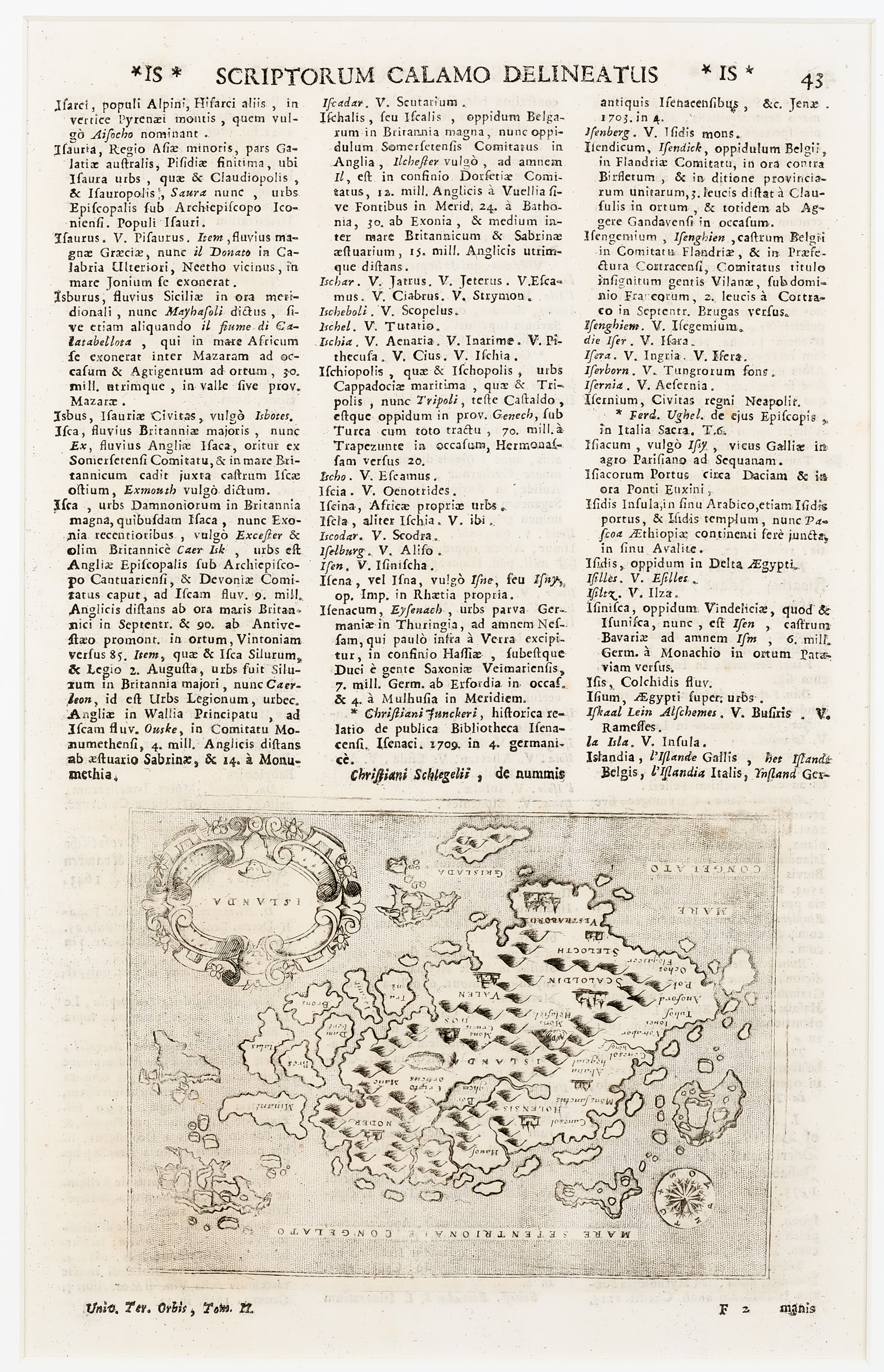
This sheet with the map of Iceland varies from another one which Lasor has published in 1713 with the headline „Descrittione Del Isola D’Islanda“ and which is contained in this collection (No. 23). The text is set less decorative, the content itself is different and placed above the map. The maps are identical but what makes this map a cartographic curiosity is that it is printed upside down on the page, most likely by a severe failure of the printmaker.
The correct printing is to be found on the sheet in islandskort.is , including a description of the history of the map, but the first mentioned Lasor map of 1713 is obviously not part of the collection of „Landsbokasafn Islands“.
Why Lasor a Varea has the same map of Iceland into two different texts in the same year remains his secret.
Comment by the collector
As the sheet with the correct printing of the map is missing in the Schulte Collection it is on my search list.