
Charles-Francois Delamarche (1740 – 1811)
was the most successful French cartographer and globemaker of the late 18th century.
A lawyer by trade, Delamarche entered the map business in 1747 with the acquisition of Robert de Vaugondy‘s map plates and copyrights.
He prospered as a map publisher, acquiring most of the work from earlier generation cartographers Lattre, Bonne, Desnos, Janvier and especially de Vaugondy whose maps he re-worked and re-printed.
Delamarche styled himself the „successeur de MM. Sanson et Robert Vaugondy, Geographes du Roi et de M. Fortiin, Ingenieur-mecanicien du Roi pour les globes et les spheres“.
His work included celestial and terrestrial globes and he was the first French globemaker to aim his product directly at the commercial market. Charles-Francois was followed by his son Felix. The firm continued to publish maps and globes until the middle of the 19th century.
Map details
The source of this very rare and large map is unknown. Either it has not been included in an atlas or the explanation to be found in the „Comments by the Antiquarian“ is right.
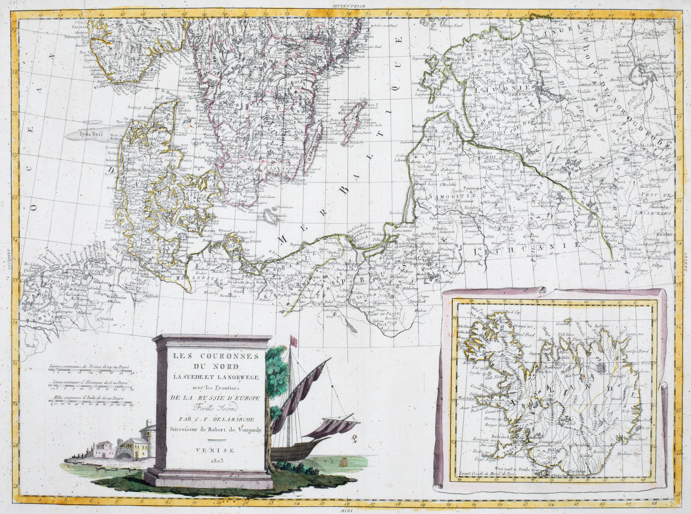
The placement of the main components of maps is rather unusual: The inset map of Iceland in the lower right corner, three distance scales on the left, the title cartouche between both and the map at full length above them.
The decorative title cartouche shows a huge block of stone in which all important information on the map is chiseled: the presented countries, not only Sweden and Denmark but also Russia („De La Russie D’Europe“), the name and the importance of the author („ Successeur de Robert de Vaugondy“) and the year and place of publication („Venise 1803“). Behind the block of stone two houses, a big tree and the bow of a sailing vessel are to be seen.
The map shows Denmark, the southern part of Norway and Sweden, the Baltic region and the northern part of Prussia. The content is extremely detailed.
Information in the inset map of Iceland which looks like a rolled-out map is rather poor. Its content is nearly identical with another map of Delamarche (No. 88). „Islande“ is written across the depiction of the country. The interior is mainly filled with mountain ranges. The place names regard mainly Hekla (which is not highlighted), the bishoprics Skalholt (with a tiny church symbol) and Holar („Hola“) and four glaciers („Iokul“). The Arctic Circle is not marked.
Comments by the antiquarian
I bought this map in December 2021 from Rasmussen Antique Maps, Books and Prints in Copenhagen. With regard to the source of the map the owner Mikkel refers to „Venise“ in the cartouche of this map and a similar cartouche in style in a map of the British Isles, offered by Altea Gallery in London. Their specialists write: „It comes from a never-published atlas by the ‚Società Calcografica‘, a partnership of the main Venetian publishers of the period, Zatta and Giuseppe Antonio Remondini, which probably ended with Zatta‘s death in 1804.“ And Mikkel adds: „I am almost certain, this is the source of the map, which is why it is hard/impossible to trace down. I hope it helps.“
Indeed and thank you Mikkel!