
Giacomo Sarzina (c 1570 – 1641)
was a printer in Venice about whom little is known. He boasted the official definition of „Stampatore dell‘Accademia degli Incogniti“ which was founded in 1630. He was also editor of the „Anfiteatro d‘Europa“ which was published in Venice in 1623 and written by Giovanni Doglioni (1548- 1629) who was an Italian mathematician and notary. The „Anfiteatro d’ Europa“ has never been reissued.
In this atlas, together with the text, there are an oval world map and 33 other maps, mainly of Europe including this map of the North Atlantic. The engraver of the miniature plates is not known.
Obviously Sarzina used new plates but his maps were copied after others.
A comparison with two similar maps in the „Schulte Collection“ illustrates that Sarzina used the map in Ortelius‘ „Epitome“ (No. 151) and not the map in the pirate edition of Pietro Marchetti (No. 112) which were both published in 1598.
Map details
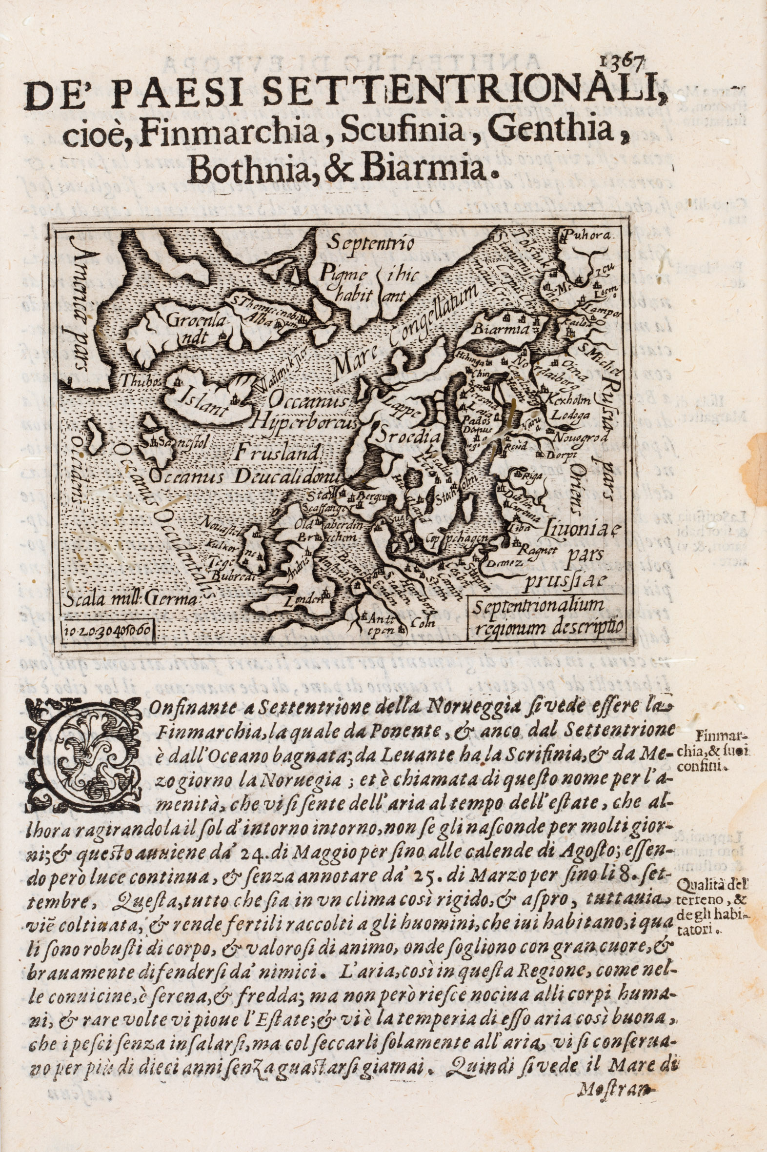
This miniature map from the very rare atlas „Anfiteatro d’Europa“ is framed by text in Italian language, with the headline on top outside the neatline: „De‘ Paesi Settentrionali …“. There is small title cartouche „Septentrionalium regionum descriptio“, in a rectangle in the lower right corner.
The map covers the area between „America pars“ in the west and „Russia pars“ in the east. It includes a mileage scale („Scala Mill:Germa“) in the lower left corner. There is a big land in the far North which lookes like a pensinsula region named „Septentrio“ (North) but there is none in reality. Even more mysterious is the text „Pigmei hic habitant“ (Pygmies live here).
The map also shows the British Isles, Scandinavia, the Baltic region and the northern part of Germany. The Faroe Islands are missing but two unnamed fantasy islands, one is most likely Frisland are illustrated.
„Islant“ is printed across the depiction of the island. There are no place names at all.
A comparison between this map (No. 149) of 1623 and the Ortelius map (No. 151) of 1598 shows that the sections of the image, the geographical shapes and the location names are very similar. However, on this map, the impressive sailing vessel is missing and the distance scale is without a circle.