
Henri Abraham Chatelain (1684 – 1743)
was a Huguenot pastor who lived consecutively in Paris, London, The Hague and Amsterdam but he is best known as a Dutch cartographer. Groundbreaking for its time his work was based upon studies of geography, history, ethnology, heraldry and cosmography. His publishing firm of Chatelain, Chatelain Freres and Chatelain & Fils was recorded in Amsterdam from around 1700 to 1770. The most famous work was a family enterprise, involving Henri Abraham, his father Zacharie (d. 1723) and his son also Zacharie (1690 – 1754): the „Atlas Historique“, published in Amsterdam in seven volumes between 1705 and 1720 and later reissued by Zacharie Junior between 1732 and 1739. This encyclopedic work was devoted to the history and genealogy of the continents.
Map details
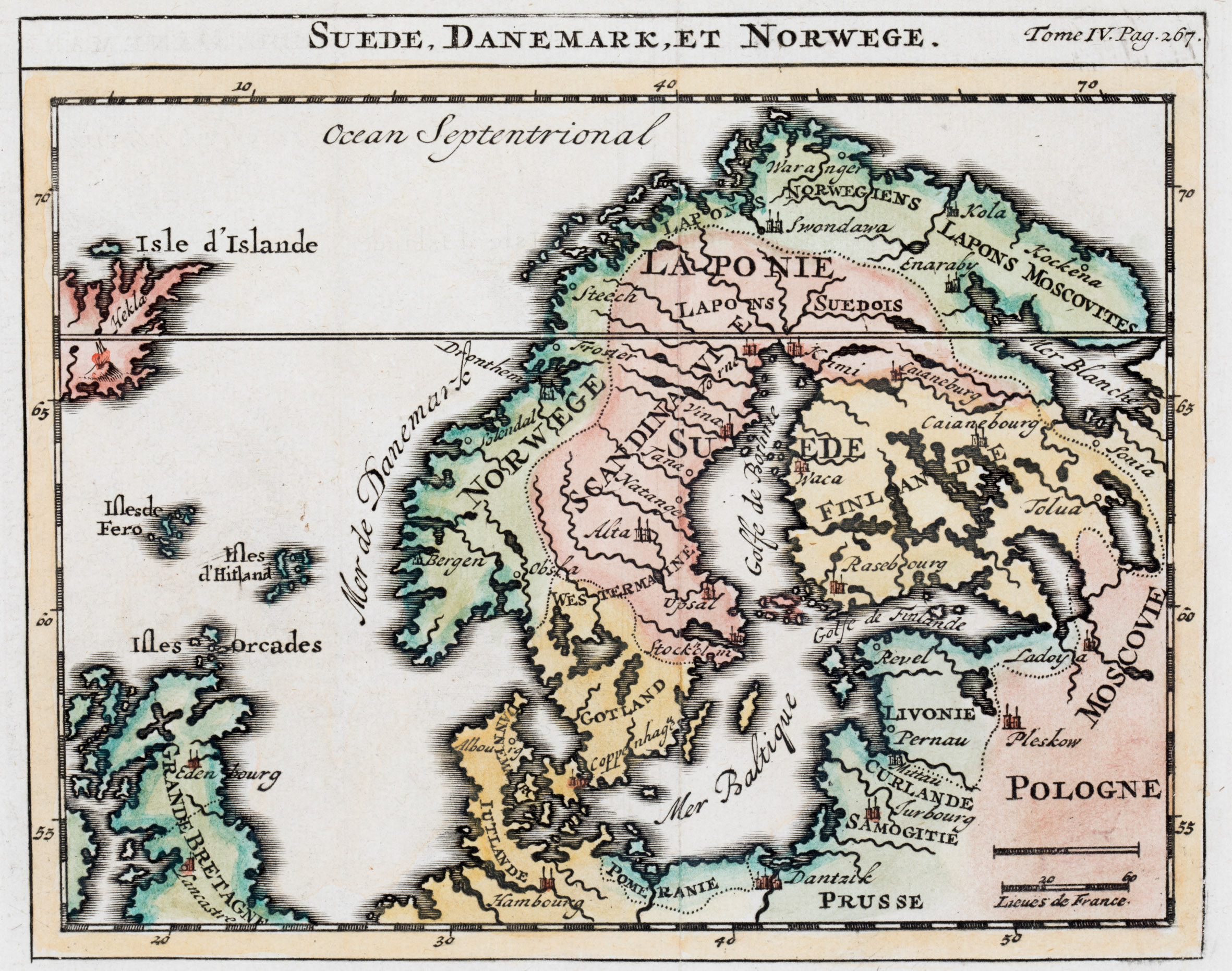
This rare map is from one of Henri Abraham Chatelain‘s editions of the „Atlas Historique“. Its title is written on top outside the neatline. „Isle d‘Island“ is drawn to scale in the upper left corner.
The map covers Scandinavia, about the eastern half of Iceland, the Faroe, Shetland and Orkney Islands, Scotland, most of England, the eastern part of Ireland, the Baltic region, „Moscovie“, Poland („Pologne“) which looks like a second title, with a distance scale underneath), Prussia („Prusse“, Pomerania („Pomeranie“) and the northern part of Germany.
In the map of Iceland there is only one place name: Hekla shown in a fiery eruption. A main error is the positioning of the Arctic Circle which runs through the middle of Iceland.
The style of this map of Henri Chatelain resembles the maps of Elias Baeck (No. 152), Daniel Daniel de Feuille (No. 144), Claude Buffier (No. 111) and the anonymous map (No. 100). However its section is smaller and the most noticeable difference is concerning the western part of Iceland which is cut off on this map. With regard to this last point there is a similarity to Herman Moll’s map of 1709 (No. 117).
COMMENTS BY THE ANTIQUARIAN
Though only half of Iceland is to be seen I thought it worth to be included in the „Schulte Collection“ because I had acquired a similar map (No. 117) earlier.