
Antonio Zatta (1722 – 1797)
was an Italian cartographer and the most prominent map publisher of the late 18th and early 19th century, working in Venice. The major contribution of Zatta is the four volume world atlas „Atlante Novissimo“, published between 1779 and 1785. The illustrations were designed by Giovanni Pitteri and engraved in copper by Guiliano Zuliani. Besides his publications nothing is known about Zatta‘s life.
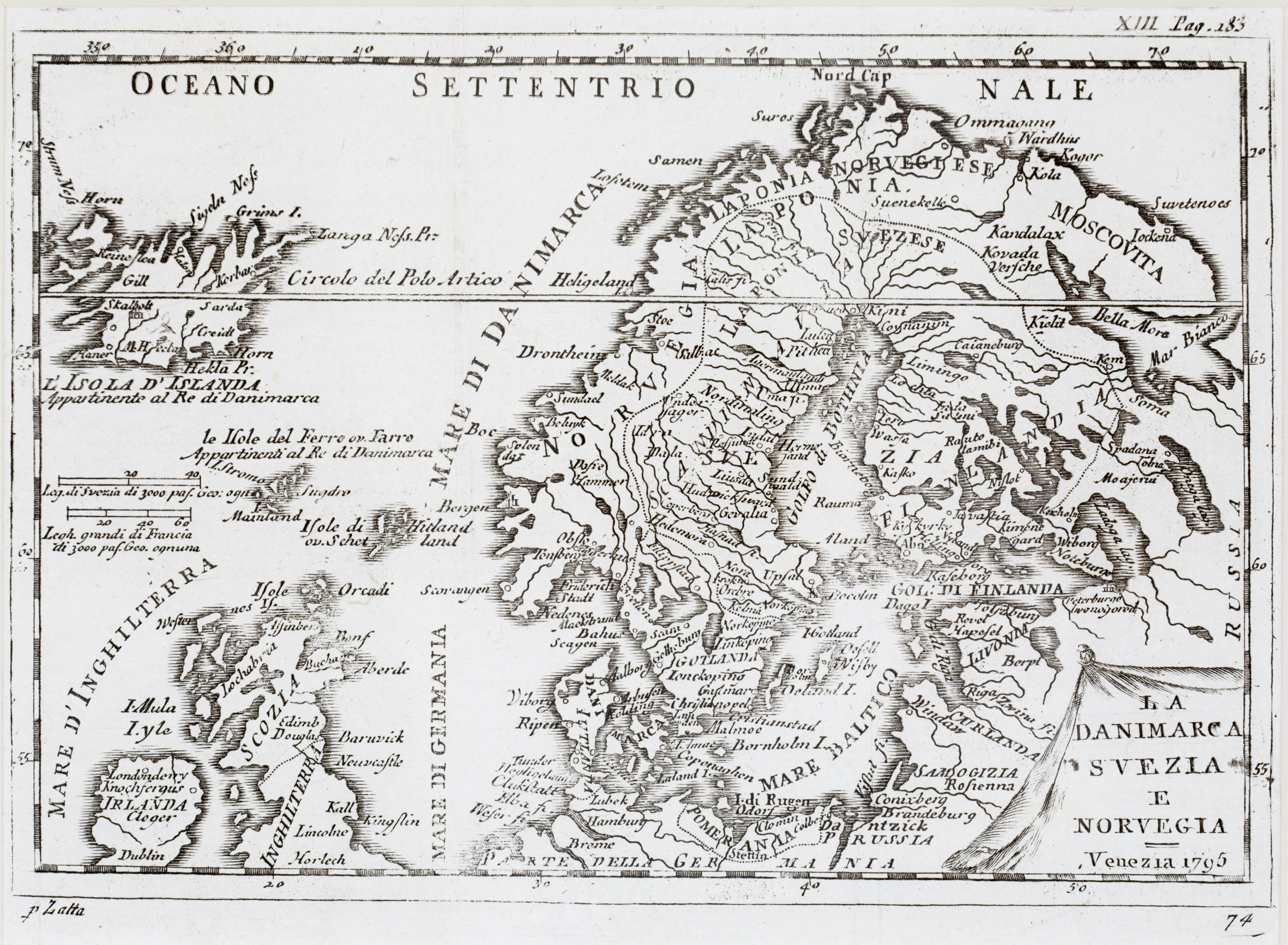
Map details
Antonio Zatta is mentioned underneath the map on the left but the source of this uncommon map is unknown. It is decorated with an unusually shaped title cartouche in the lower right corner. L’Isola D‘Islanda is drawn to scale in the upper left corner, together with the notice underneath: „Appartinente al Re di Danimarca“ (Property of the King of Denmark). In the North Atlantic two distance scales are depicted.
The map covers Scandinavia, Iceland, the Faroe, Shetland and Orkney Islands, most of Ireland and England, the Baltic region, Prussia, Pomerania and the northern part of „Della Germania“ (Germany). „Russia“ is written vertically on the right hand side of the map.
Along the coastline of Iceland and also in the interior there are only very few place names, amongst them the bishoprics Skalholt and Holar („Halon“) and „M. Hecla“ (all without highlighting). A main error is the positioning of the Arctic Circle („Circolo del Polo Artico“) which runs through the middle of Iceland.
In the „Schulte Collection“ there are three more maps which look quite similar but mainly languages, frame decorations and publication years differ which spread nearly all over the 18th century.
The map of Claude Buffier (No. 111) in Italian language is the latest map of them (1790). The anonymous map (No. 120) was published in 1720 in Italian language. The map of Daniel de Feuille (No. 144) in French language ist the earliest (1702). In comparison to the others in this map (No. 161) the ornamental emblems of countries and regions are omitted and therefore its size is smaller. However, there is one more map (No. 111) which is nearly completely identical, besides the year in the title cartouche which is 1790. While the source of Buffier‘s map is his own atlas from the same year (1790), it is rather mysterious where this map (No. 161) has been published. According to literature the source of this rare map is the „Atlante Novissimo“ but this atlas was published only until 1785, however in the title cartouche clearly the year 1795 is written, probably for a later edition which has never been realized (?)