
Antonio Zatta (1722 – 1797)
was born in Berlin and first practiced as a distiller. Latest since 1799 he described himself a copper printer and worked continuously in this profession. Jättnig became well-known for his „Karte der Königlich Preussischen Regierungsbezirke Berlin, Potsdam, Magdeburg, Merseburg und Erfurt“ (Map of the Royal Prussian Administrative Districts …). Later he became the founder of a copper printer family as also his sons and his grandchildren followed in his tracks.
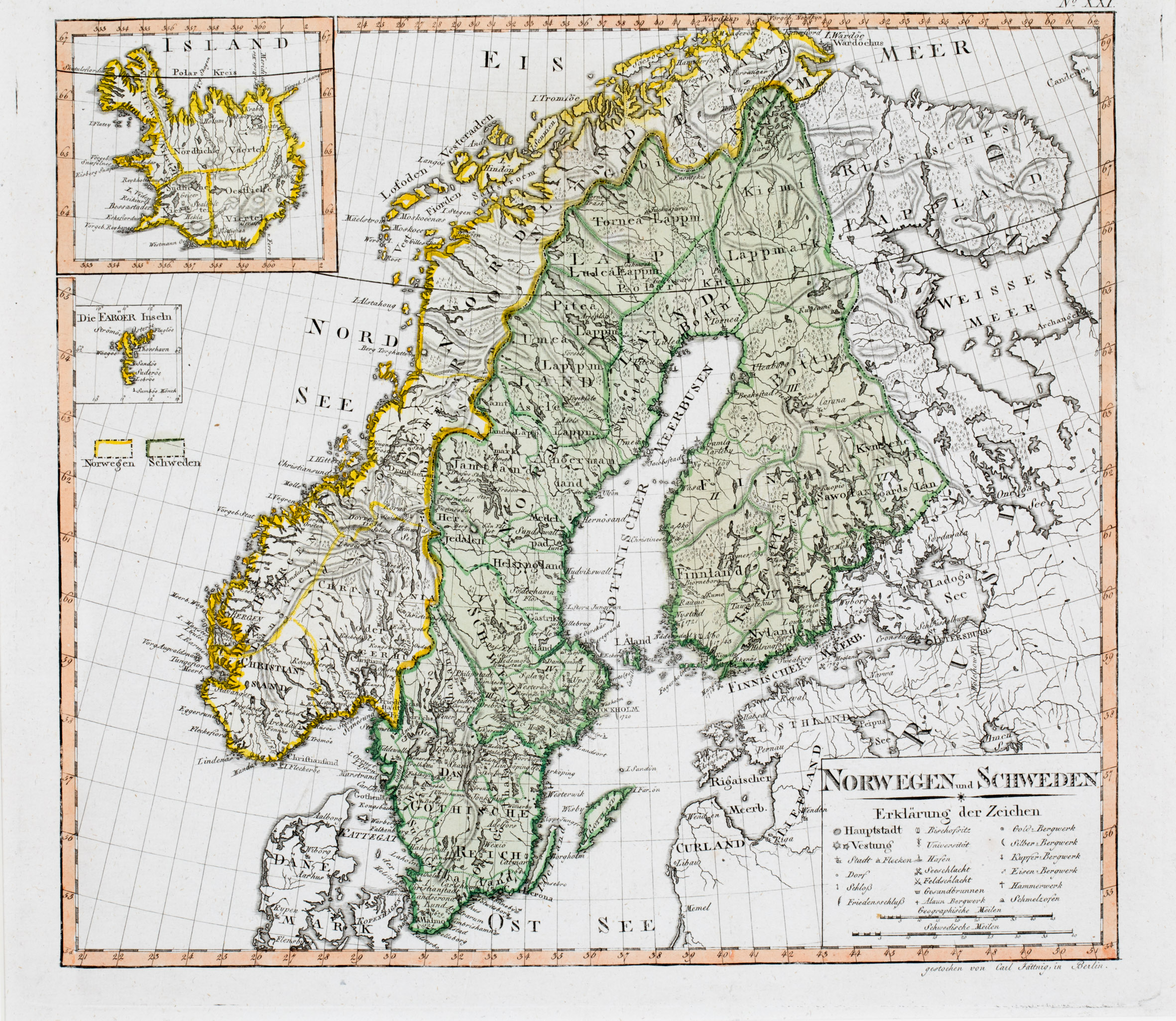
Map details
This very rare map is taken from Heinrich de Marees, „Tabellarisches Handbuch der neuern Geographie, Statistik und Geschichte für Schulen“; herausgegeben von Funke, mit Charten von Sotzmann, 2 Hefte, Berlin 1802. Carl Philipp Funke was a teacher and natural scientist, Daniel Friedrich Sotzmann a geodesist and cartographer.
A simple rectangular title cartouche with an explanation of symbols and two distance scales is to be found in the lower right corner. The map shows Scandinavia, „Russisches Lappland“ (Russian Lapland) and the Baltic region with numerous place names.
Maps of Iceland and the Faroe Islands are placed as insets in the upper left corner.
Iceland is divided into its four districts. There are many place names along the coastline mainly in the western part of the island and only few in the interior. The bishoprics Skalholt and Holar („Holum“) are depicted with church symbols, Hekla is named but whether the round icecap south of it is the snow covered volcano or a nearby glacier remains unclear. Remarkably „Geiser“ is printed where the „Great Geysir“ is located and in the northern part the longest fjord of Iceland „Eyerfjord“ (Eyjafjördur), Myvatn and the volcano „Krabla“ (Krafla) are named. The Arctic Circle is marked and runs in Scandinavia rather correctly but not in Iceland. In reality it crosses Grimsey which is missing on this map and the western fjords lie below it.