
George Alexander Cooke (1781 – 1834)
was born in London. His father was a native of Frankfurt who settled in early life in England and became a wholesale confectioner. In the age of 14, George Alexander was apprenticed to James Basire, a British engraver, and at the end of his training period he engraved his first plates. During the late 1700s, new lands were beeing discovered, trade routes established and stories about travel and exploration became popular in Great Britain. Therefore Cooke produced an entertaining chronicle of famous voyages and travels with the lengthy title: „A Modern and Authentic System of Universal Geography, containing an accurate and entertaining description of Europe, Asia, Africa, and America being a complete and universal history and description of the whole world, as divided into empires, kingdoms, states, republics“. The book was printed in two volumes by J. Adlard in London, Duke Street, West-Smithfield and published in 1802.
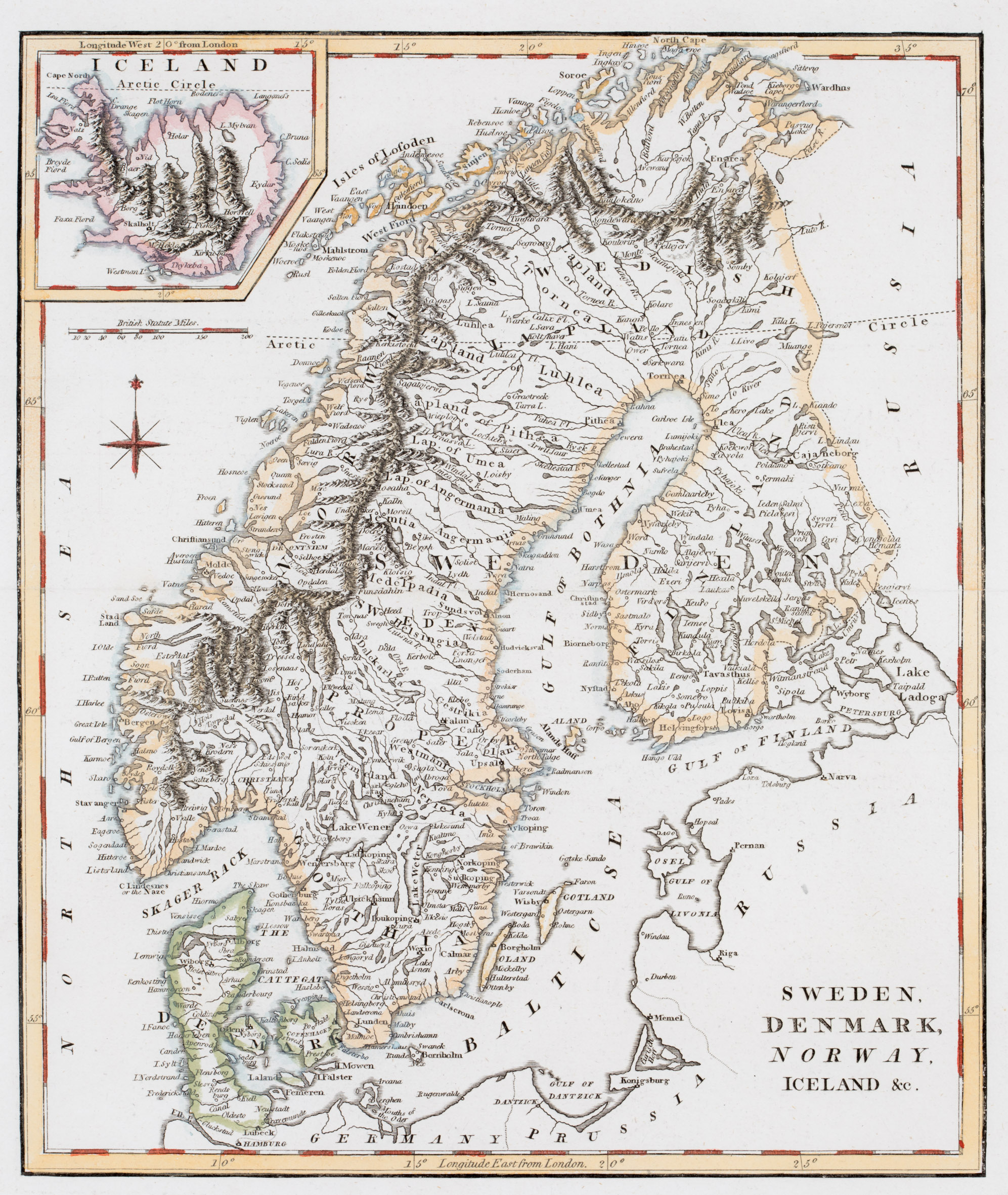
Map details
The title of this map, taken from „Modern and Authentic System of Universal Geography“, is placed in the lower right corner without any decoration. The map shows Scandinavia, the western part of „Russia“, „Prussia“, the northern part of „Germany“ and Iceland in a pentagonal inset in the upper left corner. Underneath are a compass rose and a distance scale.
In the inset „Iceland“ is written over the map which is dominated by long mountain ranges and contains only a few place names along the coastline and also in the interior, eg the bishoprics Skalholt and Holar and Mt. Hekla (all without symbols). The Arctic Circle is depicted in the main map and also in the inset but runs too far south in Iceland. In reality it crosses Grimsey and not the western fjords but the island is missing on the map.
In the „Schulte Collection“ there are four maps from four different authors which look (nearly) identical and the question is who has created the original copper plate. One answer is given by the publication dates. The map of Wilkinson (No. 164) dates 1794, the map of the anonymous author (No. 83) dates 1795, the map of Arrowsmith (No. 169) dates 1798 and this map of Cooke (No. 165) dates 1802.
The other answer lies in the fact that Wilkinson‘s name and shop location are to be found underneath the neatline and both informations have obviously been deleted by the other authors.