
Robert Wilkinson (1768 – 1825)
was an English map maker and book publisher in London. He was primarily a compiler of information from other sources. Most of his maps were derived from John Bowles who died in 1779 and from whom he took over the plate library. His major cartographic work is „A General Atlas, being a Collection of Maps of the World and Quarters, the Principal Empires, and Kingdoms Ec. With their several Provinces, & other Subdivisions, Correctly Delineated“ published in London in 1794 by Robert Wilkinson of No. 58 Cornhill. Wilkinson continued in business until the end of his life.
The „General Atlas“ was reissued several times until Wikinson‘s death in 1825. Afterwards the business and map plates were acquired by William Darton Jr, who re-issued the „General Atlas“.
Map details
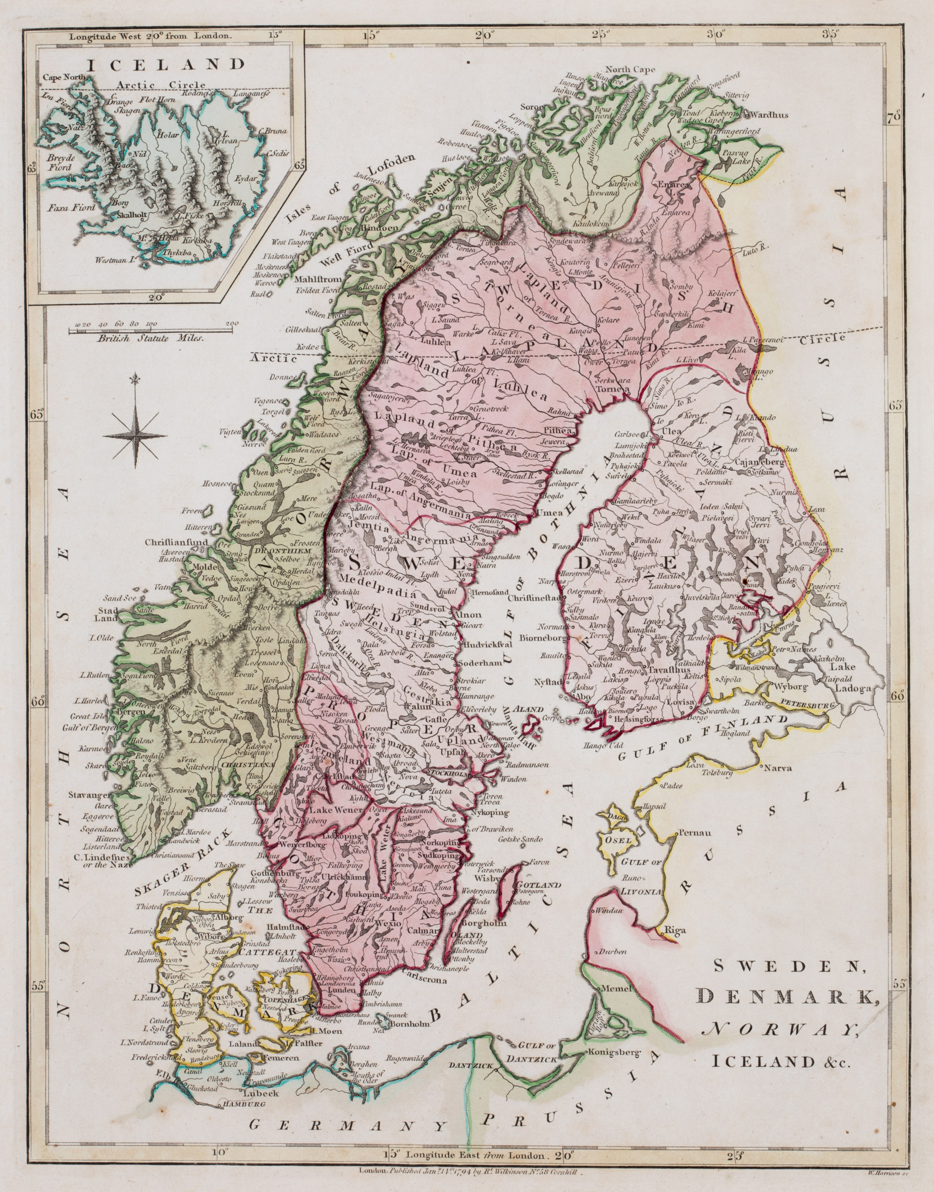
This map is from the first edition of the „General Atlas“ in which Wilkinson‘s name
and shop location are written underneath the neatline. The outlining of provinces and hand-tinting with water-colour has been done by map engraver Thomas Conder (see No. 143).
The title is placed in the lower right corner without any decoration. The map shows Scandinavia, the western part of „Russia“, „Prussia“, the northern part of „Germany“ and Iceland in a pentagonal inset in the upper left corner. Underneath are a compass rose and a distance scale.
In the inset „Iceland“ is written on top of the map which is dominated by long mountain ranges and contains only a few place names along the coastline and also in the interior, eg the bishoprics Skalholt and Holar and Mt. Hekla (all without symbols). The Arctic Circle is depicted in the main map and also in the inset but runs too far south. In reality it crosses Grimsey and not the western fjords but the island is missing on the map.
In the „Schulte Collection“ there are four maps from four different authors which look (nearly) identical and the question is who has created the original copper plate. One answer is given by the publication dates. This map of Wilkinson (No. 164) dates 1794, the map of the anonymous author (No. 83) dates 1795, the map of Arrowsmith (No. 169) dates 1798 and the map of Cooke (No. 165) dates 1802. The other answer lies in the fact that Wilkinson‘s name and shop location are to be found underneath the neatline and both informations have obviously been deleted by the other authors mentioned above.