
Author Anonymous
Map details
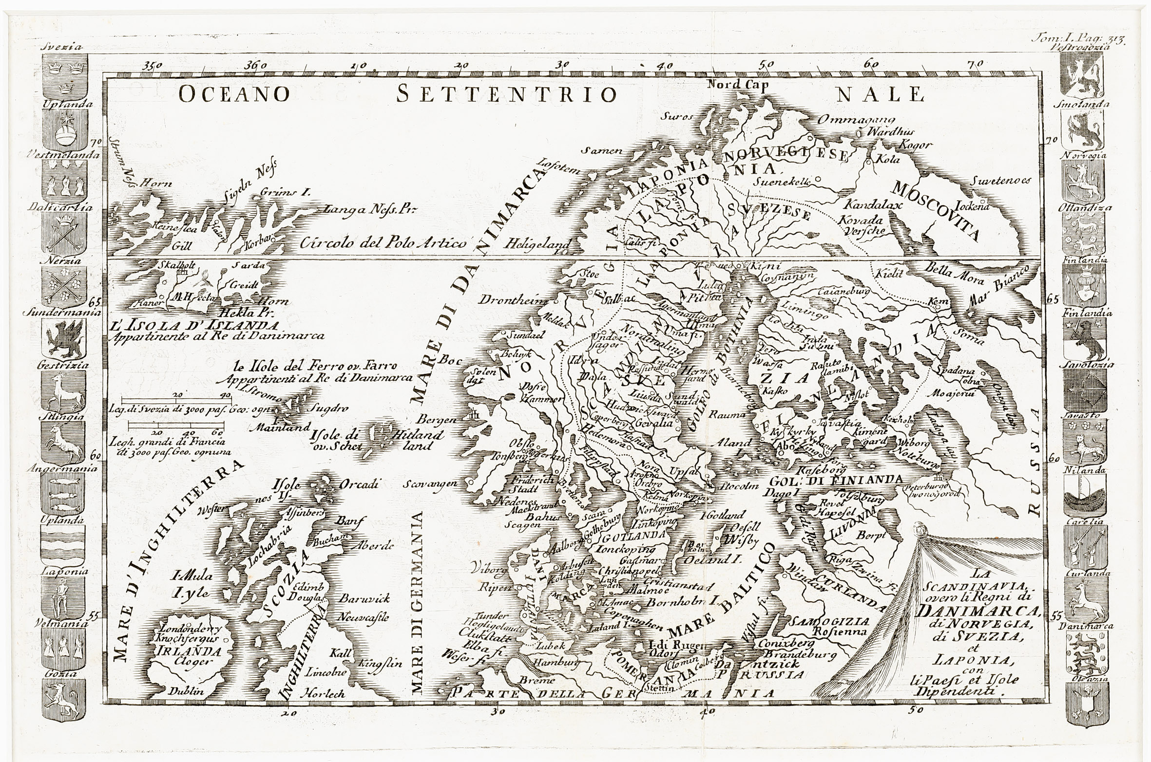
This rare map is decorated with an unusually shaped title cartouche in the lower right corner. „L‘ Isola D‘ Islanda“ is drawn to scale in the upper left corner, together with the notice underneath: „Appartinente al Re di Danimarca“ (Property of the King of Denmark). In the North Atlantic two distance scales are depicted. Ornamental
emblems of countries and regions are flanking the map.
The map covers Scandinavia, Iceland, the Baltic, the Faroe, Shetland and Orkney Islands, Ireland, Scotland, most of England and the northern part of Germany.
In the interior of Iceland there are only a few place-names: the bishoprics Skalholt and Holar („Halon“) and „M. Hecla“. A main error is the positioning of the Arctic Circle („Circolo del Polo Artico“), placed in the center of Iceland.
This map of c. 1720 resembles a map of Claude Buffier which appeared in 1790.
In the later map the title in the cartouche is reduced and „Venezia 1790“ added; furthermore the ornamental emblems of countries and regions are omitted and therefore the size of that map is smaller.
Comments by the collector
I have found this map which was unknown to me on ebay. The price of it was only 14 €. I understood the short description in Italian language thanks to having learnt Latin nine years at school but I was not able to do the formalities of an acquisition.
Therefore I asked Marcus Perini, owner of Perini Libreria Antiquaria in Verona from which I had bought the extremely rare Quad map of 1592 to buy it for me. He was kind enough and In the end I only paid 50 € for this scarce map.