
Gilles de Vaugondy (1688 – 1766) & Didier Robert de Vaugondy (1723 – 1786)
were leading French publishers, cartographers and engravers, active in Paris during the mid-eighteenth century who worked together as father and son. Their best-known work is the „Atlas Universel“ (1757) which took over 15 years to create and was released in a folio and a 3/4 folio edition. They were inheritors to the important cartographic firm of Nicolas Sanson whose stock applied much of their initial material. Soon they produced their own substantial corpus of work. The Vaugondys were well respected for the detail and accuracy of their maps. Unlike many competitors of this period who published „speculative cartography“ without significant research, the Vaugondys compiled each map based upon their superior geographic knowledge, literature study, the journals of contemporary explorers and missionaries as well as direct astronomical observation. Gilles served as a geographer to the French King Louis XV and later his son Didier Robert took over this prestigious position.
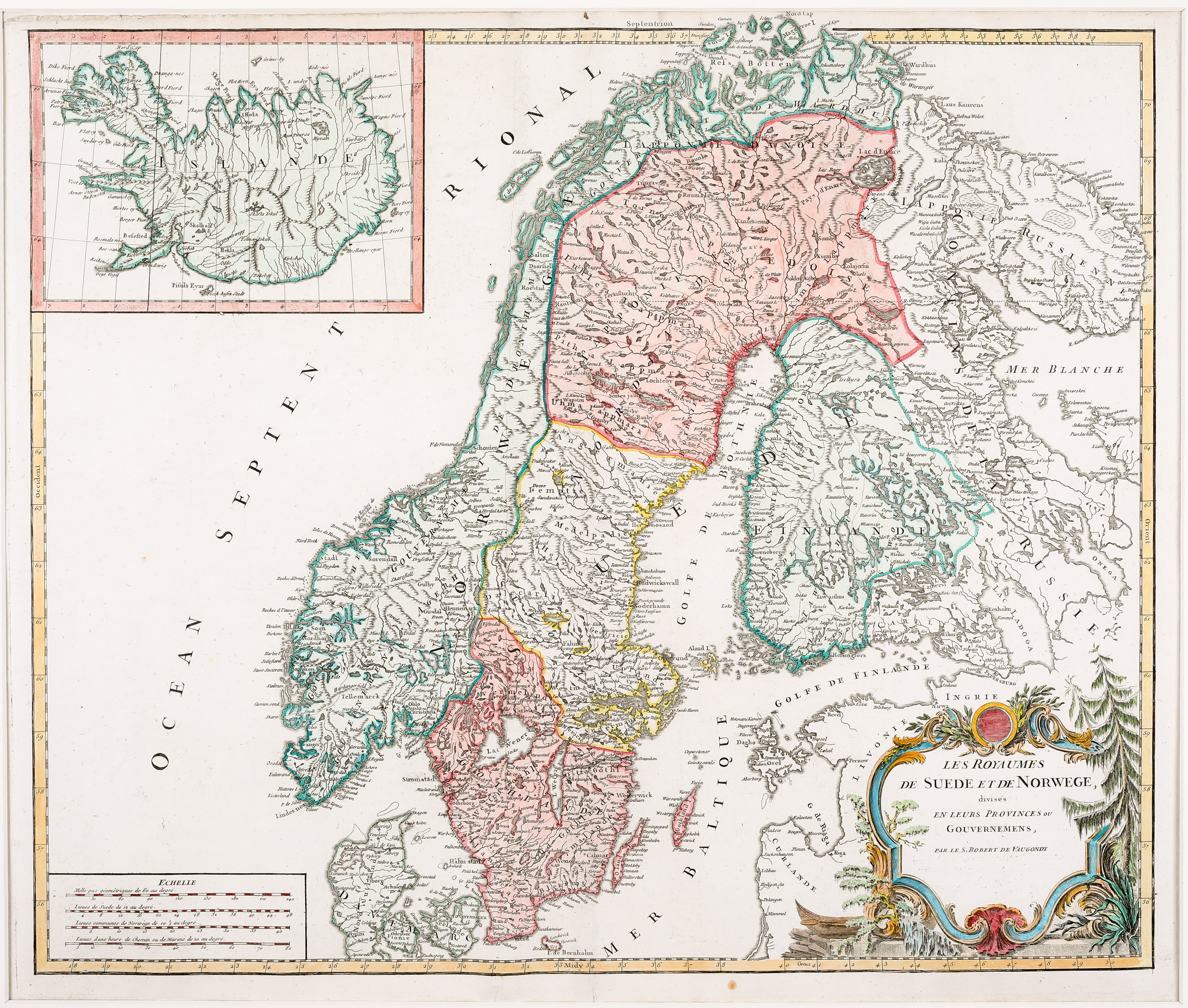
Map details
This beautiful map has a decorative title cartouche in the lower right corner. It covers Scandinavia, the Baltic, a part of Russia and includes an inset map of Iceland in the top left quadrant. The map is not dated (most likely c. 1750) and the source is unknown.
There are several versions of this map; three of them are to be found in the „Schulte Collection“. What they have in common is the naming of the author: „Par le Sr. Robert de Vaugondy“. The variations can be attributed to the existence of the text, the mentioning of „Avec Privilege.“ and the year underneath the name. This map has the least information. Only the name is mentioned but text, privilege and year are nonexistent.
The three maps also differentiate in shape and depiction detail of the inset maps of Iceland. Two maps are the Knoff typ, one is the Sanson type. This one is the Knoff type.
Information is rather poor. Title and name underneath the map are missing. Instead of that, „Islande“ is written into the depiction of the country. Furthermore, the division into four parts and the Arctic Circle are lacking. The interior of the country only contains the names of the volcano Hekla and of the bishoprics Skalholt and Holar without any decoration.