
Jacques-Nicolas Bellin (1703 – 1772)
was a French hydrographer, geographer and member of the intellectual group „Philosophes“. Born in Paris, at the age of 18 years, he was appointed hydrographer to the French Navy. In 1741 Bellin became the first „Ingenieur de la Marine“ of the „Depot des Cartes et Plants de la Marine“ (French Hydrographical Office) and was named „Hydrographe Officiel du Roy de France“. During his reign the Depot published a prodigious number of maps and atlases, e.g. the „Atlas Maritime“ (1764) and the „Petit Atlas Maritime“ (1764). Bellin also contributed a number of maps to the „Histoire Generale des Voyages“ of Antoine Francois Prevost d‘ Exiles“ (1697 – 1763), a French author and novelist (e.g. „Manon Lescaut“), simply known as „l‘Abbe Prevost“. Prevost‘s collection was printed for the first time in 1746 and it continued until 1789, more than 20 years after his death. Many of Bellin‘s maps were copied by other mapmakers.
Bellin‘s work focussed on function and accuracy, tending to be less decorative than the 17th century cartographic images, thus gaining for France the leading role in European cartography in the 18th century.
Map details
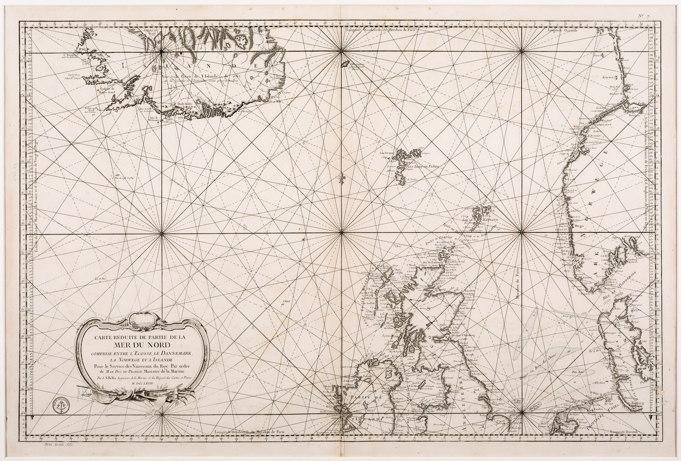
This large decorative sea chart of the North Atlantic shows Iceland, the Faroe, Shetland and Orkney Islands, Norway, Denmark, Scotland, the northern parts of England and Ireland and the northwestern parts of „Provinces Unies“ (Netherlands and Germany).
An ornate title cartouche with a small vignette of a ship at sail adorns the bottom left corner. Seven compass roses are spread over the North Atlantic and the seas are crisscrossed with rhumb lines, supplemented by some depth soundings and banks, which could help direct ships around the small islands and narrow inlets.
The seal of the „Depot de la Marine“ appears at bottom left and under the neatline a contemporary price „Prix trente sols“ is printed. Being a sea chart, place names of villages, ports and forts line the coasts, with very little inland information.
Iceland plays a dominant role in this map though it is placed in the upper left corner and appears much larger than it really is. The north of the island is cutoff for unknown reasons. In the interior there is written in three lines:
ISLANDE
voir la Carte de l‘Islande de 1767
ou les Costes et l‘Interieur sont plus detailles
(Look at this map … The coasts and the Interior are more detailed.)
However, there is only one place-name: „Mont Hekla“.