
Johann Christoph Matthias Reinecke (1770 – 1818)
was a German universal scholar who has studied Theology and received a doctoral degree in Natural Sciences before he took a job as teacher in Gotha and started writing poems, novels and songs. He also worked as cartographer in the publishing house Bertuch which between 1790 and 1830 edited the „Bilderbuch für Kinder“ (Children‘s Picture Book) and drew maps for the „Allgemeiner Hand-Atlas der ganzen Erde“ (World Atlas) for the renowned Geographisches Institut in Weimar.
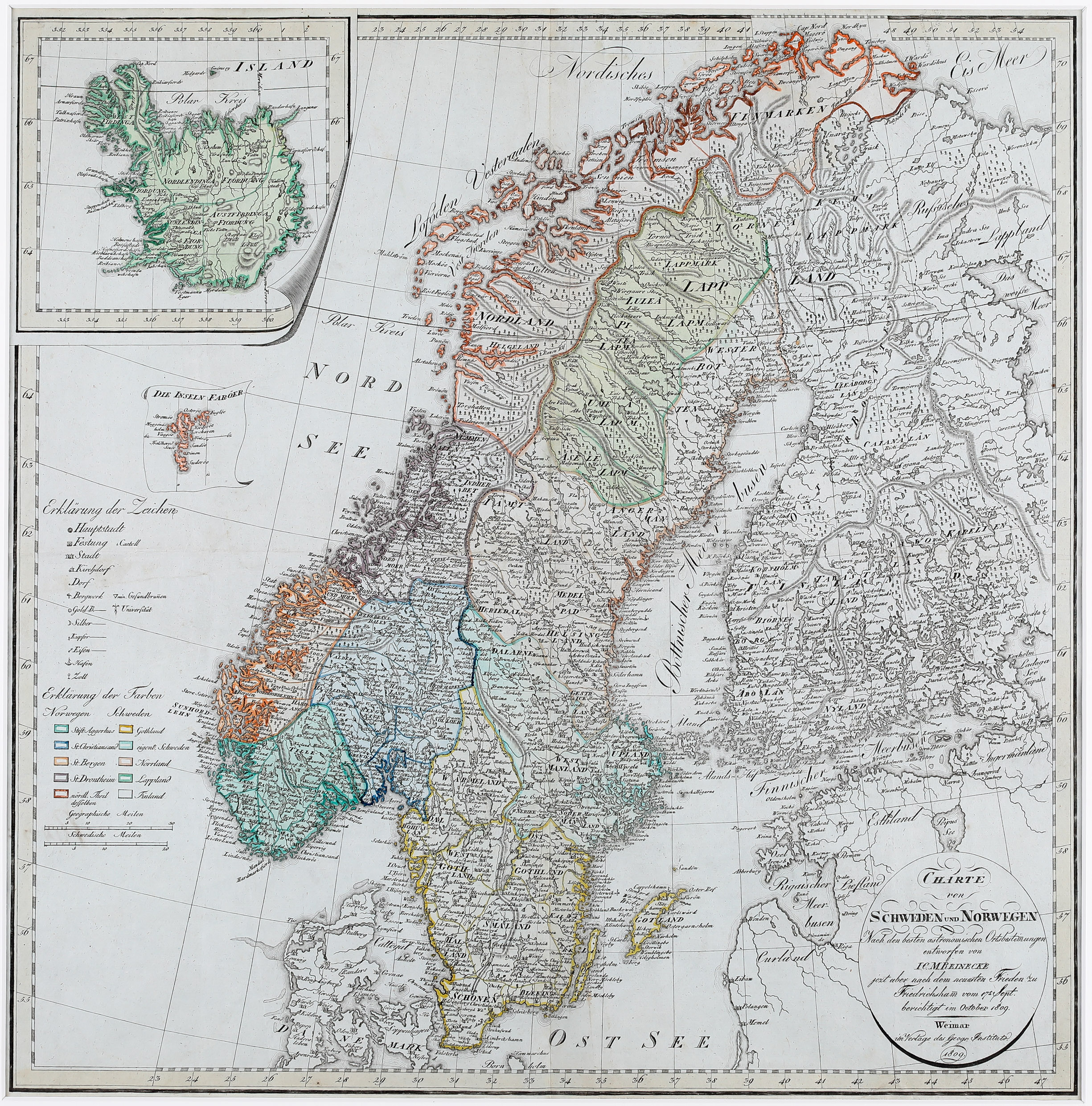
Map details
Charte von Schweden und Norwegen – Nach den besten astronomischen Ortbestimmungen entworfen von I. C. M. Reinecke jetzt aber nach dem neuesten Frieden zu Friedrichshan vom 17t Sept. berichtigt im October 1809. Weimar m Verlage des Geogr. Instituts. 1809.
This map has been published by the Geographisches Institut in Weimar.
The title cartouche is in the bottom right corner of the map which shows Scandinavia, the Faroe Islands and the Baltic, with an inset of Iceland in the upper left corner.
On the left of the sheet there is an explanation of the symbols („Erklärung der Zeichen“) and an explanation of the colours („Erklärung der Farben“), with two distance scales underneath.
The visual presentation of Iceland is unique. It looks like turning a page of a book. Also the contents of the inset is strange in some respect. The name „Hekla“ is written near the southeast coast of Iceland. The name of the bishopric Skalholt is written strangely: „Sk“ on the left and „alholt“ on the right of a lake. The church symbol is missing while it can be found next to the other bishopric Holar („Hoolum“). Astonishingly several glaciers („Iökull“) are named. The Arctic Circle („Polar Kreis“) runs south of Grimsey and crosses the northernmost tip of the westfjords which means it is too far south.
Reinecke has changed the map continuously until 1817.
Comments by the collector
The „Bilderbuch für Kinder“ describes mot only animals and plants but also the peculiarities of countries. It is illustrated with more than six thousand copper prints, many of them coloured. Iceland is covered in the book, mainly nature and people, including a map „Charte von Island“ dated 1815 and ten views (e.g. Hekla, geysers and rural life). All of them and also the map are in my private collection of books and views.