
Johann Christoph Matthias Reinecke (1770 – 1818)
was a German universal scholar who has studied theology and received a doctoral degree in Natural Sciences before he took a job as teacher in Gotha and started writing poems, novels and songs. He also worked as cartographer in the publishing house Bertuch which between 1790 and 1830 edited the „Bilderbuch für Kinder“ (Children‘s Picture Book) and drew maps for the „Allgemeiner Hand-Atlas der ganzen Erde“ (World Atlas) for the renowned Geographisches Institut in Weimar.
Map details
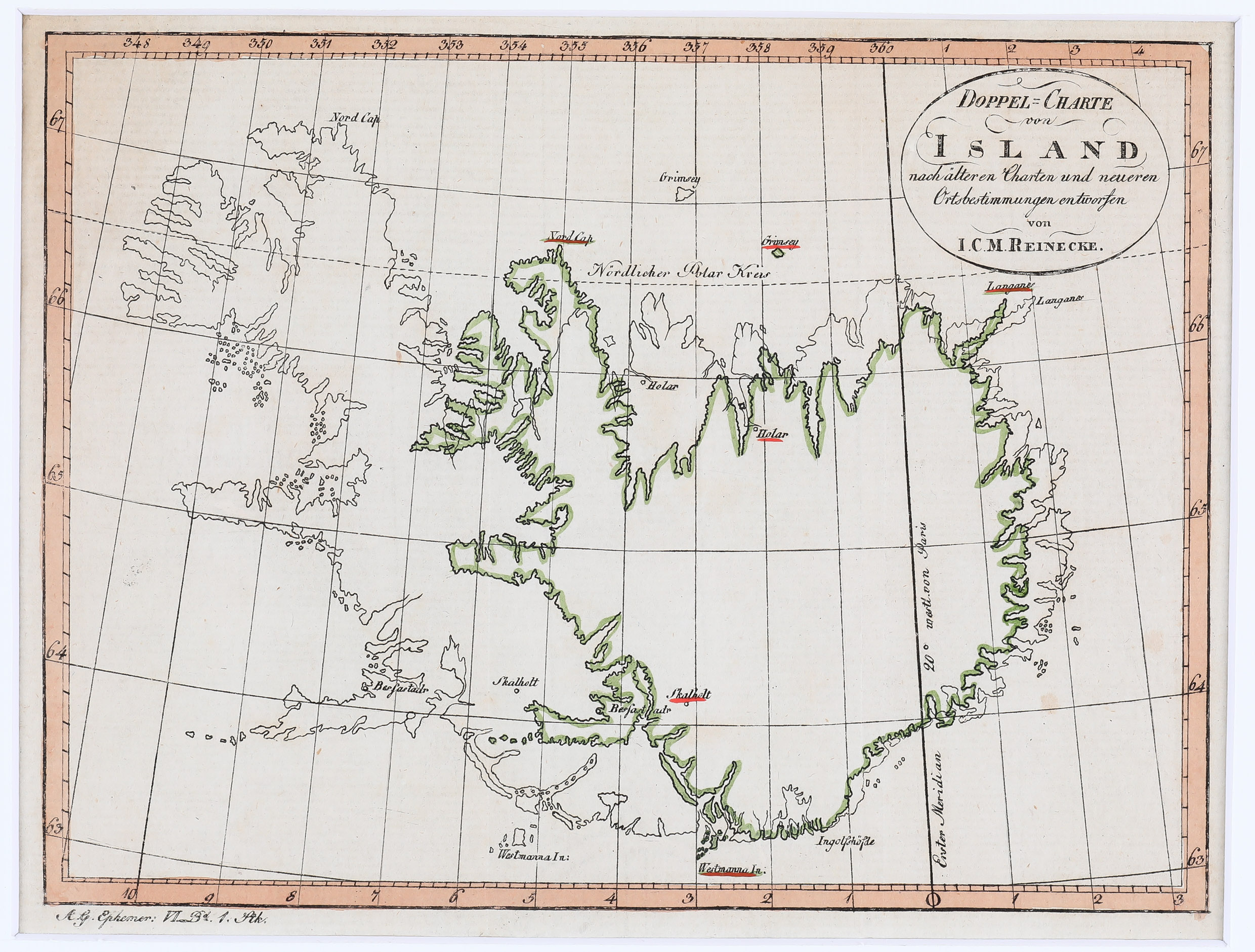
This unusual, inspiring and rare „double map“ of Iceland (source unknown) with the title cartouche in the upper right corner, focuses on the evolution of the cartography of Iceland according to Reinecke‘s opinion looking only at the shape of the country. The coastline of the earlier Knoff-type maps is drawn in black. The newer version by Verdun de la Crenne which Reinicke favours is shown in green.
In the interior of Iceland there is almost no detail to be be seen, with the exception of a few place-names as the bishoprics Skalholt and Holar. Not even the volcano Hekla is mentioned. The Arctic Circle is marked too far south: south of Grimsey and crossing the northernmost part of the westfjords.
Comments by the collector
The „Bilderbuch für Kinder“ describes not only animals and plants but also the peculiarities of countries. It is illustrated with more than six thousand copper prints, many of them coloured. Iceland is covered in the book, mainly nature and people, including a map „Charte von Island“ dated 1815 and ten views (e.g. Hekla, geysers and rural life). All of them are in my private book collection.