
Petrus Bertius (1585 – 1629)
the latinized version of his Dutch name Pieter de Bert, was a philosopher, theologian, historian, geographer and cartographer. Born in Beveren, Flanders he settled as a refugee in Amsterdam and after finishing his studies he became Professor of Mathematics and librarian at Leiden University. In 1618, he was appointed Cosmographer and Historiographer of Louis XIII of France. He was connected by marriage to Jodocus Hondius Jr. and Pieter van den Keere, his brothers-in-law and both cartographers, and this would influence his later life.
Map details
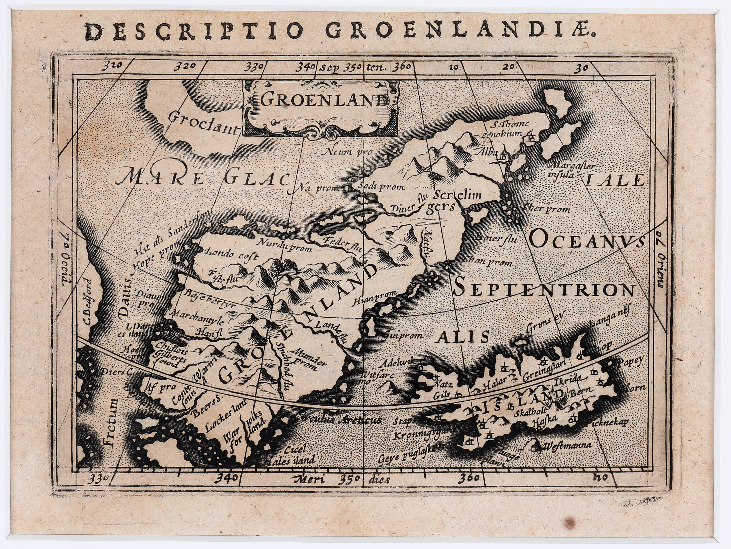
This map was taken from „ Tabularum Geographicarum Contractarum“. It is one of the first maps if not the first map to focus on Greenland.
The title cartouche „Groenland“ is centred on the top and above „Descriptio Groenlandia“ is printed. Greenland is shown as a narrow island with a central mountain range but the huge interior glacier is not mentioned. West of Greenland an island named „Groclant“ is located (which probably is Baffin Island) and across the „Fretum Davis“ (Davis Strait) is „C. Bedford“ where Nunavut (Arctic Canada) is located. The Arctic Circle is marked far too much south.
Iceland is shown in the lower right, „Island“ written in the center of the map. There are only very few place-names including the bishoprics Skalholt and Holar with church symbols. An erupting volcano is illustrated but the name of the volcano (Hekla) is missing.