
Hendrick Doncker (1626 – 1699)
was a Dutch bookseller and publisher of sea-charts and nautical atlases active in Amsterdam who started at the age of 22 years and ran his shop successfully for fifty years. He lived in the „Nieuwe Bruchsteech“ which is mentioned in many of his maps. Doncker published his first „Zee-Atlas“ in 1659. In addition to producing his own charts he also collaborated with Pieter Goos and Theunis Jacobsz in the production of the pilot guide „Zee-Spiegel“. Following his death, Doncker‘s remaining stock of maps and plates were acquired by Johannes van Keulen.
Doncker was somehow unique to this period in that he did not copy the work of earlier cartographers, instead producing his own maps. Moreover his charts were widely admired for their constant revision and overall accuracy.
Map details
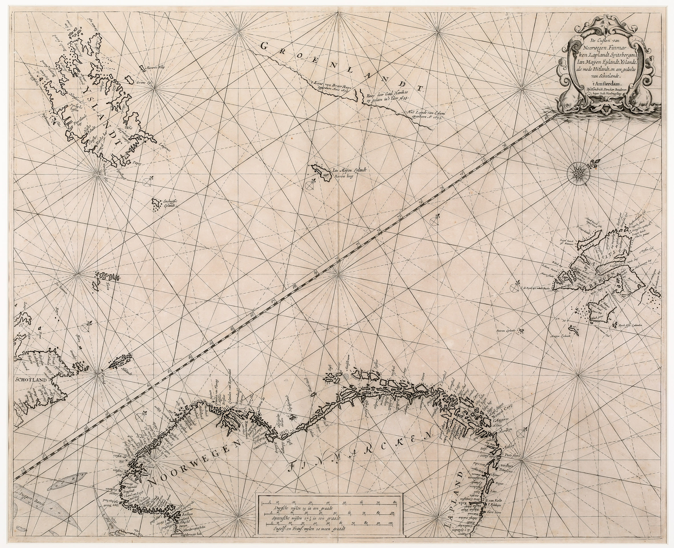
This very rare sea-chart from Doncker‘s „Zee-Atlas“ is decorated by an attractive title cartouche in the upper right corner, compass roses, rhumb lines, three distance scales with the Greenwich Meridian crossing the center of the map. It depicts the coastline of Northern Scandinavia, Scotland, Iceland, Spitsbergen, Jan Mayen Island and also a part of the coast of Greenland. The Arctic Circle is missing.
There are only a few place-names along the coastline of Iceland. The interior is completely empty.
Comment by the collector
„The chart comes from an unrecorded issue of the french edition of the Doncker atlas (not listed in Koeman)“.