
Pieter van der Aa (1659 – 1733)
was a Dutch publisher and bookseller, born in Leyden to a German woodcutter from Holstein. All three van der Aa sons came to be involved in the printing business. While Hildebrand worked as a copper engraver and Boudeweyn as a printer Pieter is best known for his voluminous output of maps and atlases. Already in the age of 23 he owned a bookshop and an auction house. He increasingly specialized in books on geography and travel. Already in 1677 Pieter van der Aa became Member of the Bookseller Guild, in 1715 Headprinter of the City of Leyden and shortly later Headprinter of its famous University. Within 50 years in the business he published a huge amount of highly decorative maps and atlases. In 1706, the „Naaukeurige Versameling Der Gedenk-waardigste Zee en Land-reysen“ (Collection of memorable sea and land voyages) appeared. In 1713 he published the „Nouvel Atlas, tres-exact et fort commode pour toutes sortes de personnes, Contenant les principales cartes geographiques“ and in 1714 the „Atlas nouveau et curieux des plus Celebres Itineraires“. In 1729 „La Galerie Agreable du Monde“ was completed and comprised 66 parts, bound in 1627 volumes. Van der Aa‘s works are richly illustrated with maps and plates but many of them contain a curious mixture of his own material, copies of maps of. other publishers and reprints made from older plates, now with his own imprint. After his death his stock was auctioned and most of it went to Covens & Mortier.
Map details
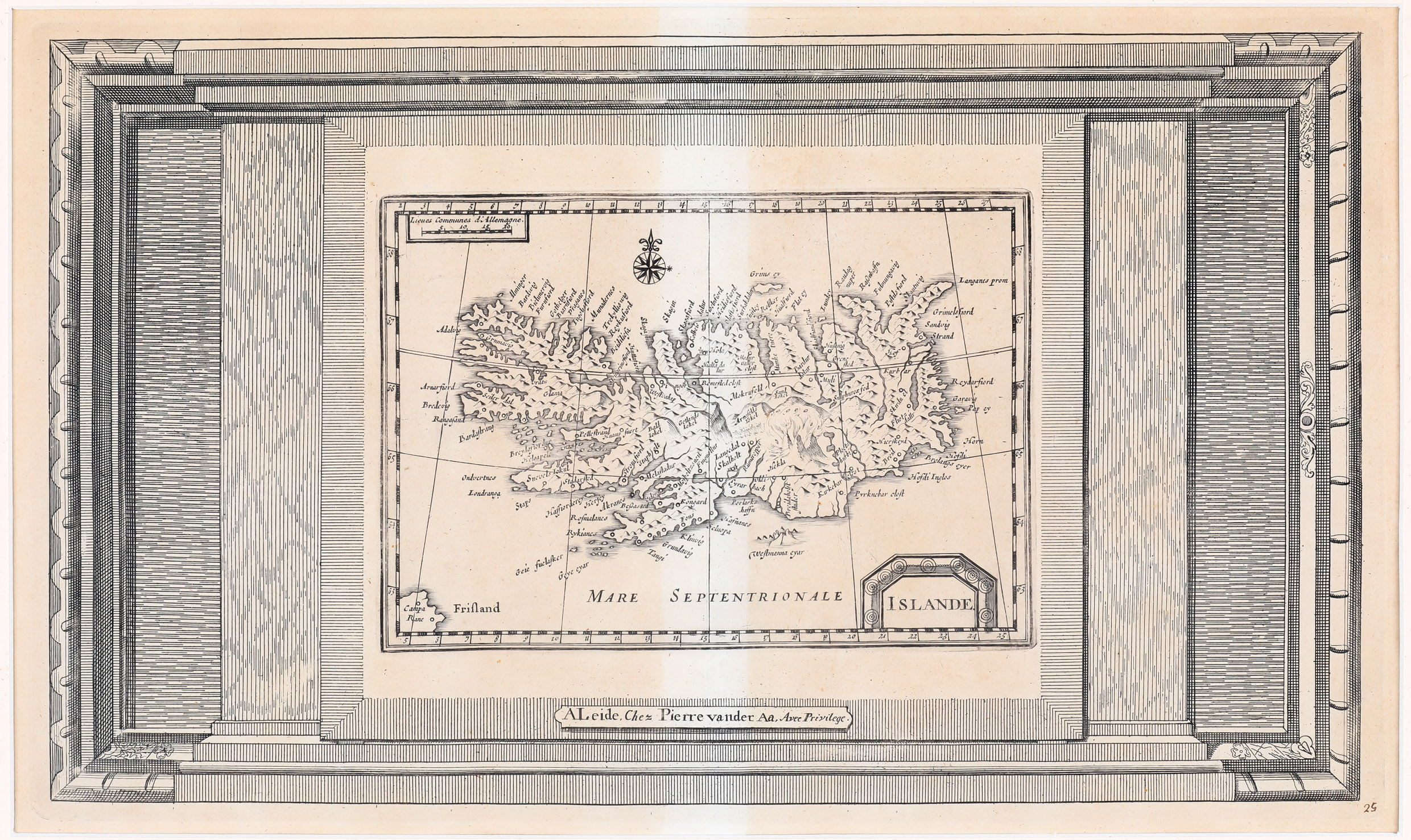
„In the beginning of the 18th century Pieter van der Aa published many collections of maps. Often it is difficult to see from what collection a particular map comes from. This map is probably from a collection in French „Soulange de son gros & pesent fardeau: ou Nouvelles cartes geographiques“. The map is printed from the same or similar plate as the Iceland map of Johannes Janssonius from 1628“ (islandskort.is).
This rare map has a rather simple title cartouche in the lower right corner, a distance scale in the upper left and a decorative compass rose in the ocean north of Iceland. In the lower left quadrant the mythical island „Frisland“ is to be seen.
In the interior of Iceland there are only a few place-names, including the bishoprics Skalholt and Holar. Astonishingly some glaciers are named. Hekla is depicted in a fiery eruption. The Arctic Circle is running far too much south.