
Abraham Ortelius (1527 – 1598) & Philip Galle (1537 – 1612)
Abraham Ortelius was a Flemish/Dutch mapmaker and is perhaps the best known and most frequently collected of all sixteenth-century mapmakers. He was born in Antwerp which was then in the Habsburg Netherlands (now Belgium). The „Ortellius family“ was originally from Augsburg/Germany, a Free Imperial City of the Holy Roman Empire. Abraham started his career as a map engraver. In 1547 he entered the Antverp guild of Saint Luke as „afsetter van Karten“ (illuminator of maps) and became a business man dealing with books, prints and maps. He travelled a lot and at the Frankfurt book and print fair he met Gerardus Mercator in 1554. Due to his influence Ortelius seems to have been attracted towards the career of a scientific geographer. In 1564 Ortelius published his first map „Typus Orbis Terrarum“, an eight-leaved wall map of the world and in 1570 the Atlas „Theatrum Orbis Terrarum“ (Theatre of the World) with 53 maps.
„The publication of this atlas marked an epoch in the history of cartography. It was the first uniformly sized, systematic collection of maps of the countries of the world based on contemporary knowledge and in that sense may be called the first modern atlas“ (Tooley, Maps and Mapmakers). In 1573 Ortelius started editing supplementary maps under the title „Additamentum Theatri Orbis Terrarum“. In 1575 he was appointed geographer to the King of Spain, Philipp II.
By the time of his death in 1598, a total of 25 editions were published including editions in Latin, Italian, German, French and Dutch; later editions were issued in Spanish and English by Ortelius‘ successors Galle and Vrients. Over the decades the atlas has tripled in size. The final edition was issued in 1612.
Also remarkable about Ortelius is that he has been the first to underline a similarity between the coasts of America and Europe-Africa and to propose a continental drift as an explanation.
Abraham Ortelius is often considered as the father of the Golden Age of the Dutch cartography. His death and burial in the St. Michael‘s Abbey in Antwerp were marked by public mourning. The inscription on his tombstone reads: „Quietis cultor sine lite, uxore, prole“ (Served quietly, without accusation, wife and offspring).
Philip Galle was a Flemish engraver, publisher and dealer, born in Haarlem.
As Ortelius‘ groundbreaking large-format Atlas „Theatrum Orbis“ proved to be such an enormous publishing success Galle saw the chance for a smaller, more affordable format. In 1577 he published the miniature-atlas, named „Epitome du theatre du monde …“ Enormously popular, this work was primarily used by travellers, students and others for whome the „Theatrum“ would have been inconvenient. Copies were eagerly sought and as a consequence, over 30 editions were published in different languages.
Map details
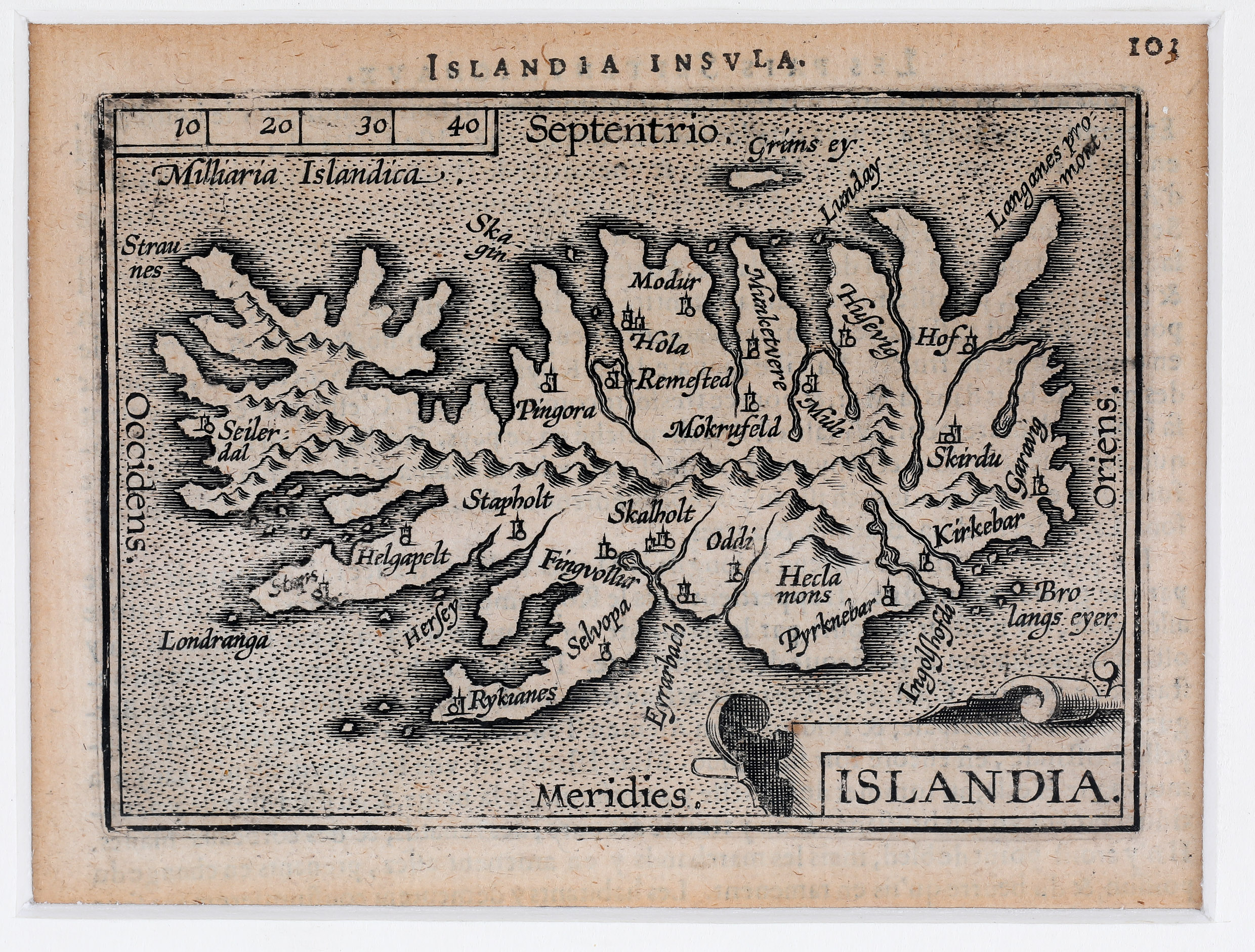
This miniature map from „Epitome“ has a title cartouche in the lower right corner and the headline „Islandia Insula“. In comparison with Ortelius‘ „Theatrum“ of 1585 the map suffers from the described reduction of size which has claimed many place-names and all the creatures in the sea. There are quite a few churches depicted, amongst them the bishoprics Skalholt and Holar. The famous volcano is named („Hecla mons“) but only one of many mountains on the map.
The main differences between this map and the later Ortelius/Vrients map of 1601 are the headline (here „Islandia Insula“), the distance scale in the upper left corner (here „Milliaria Islandica“), the border (here a simple line) and the longitudes and latitudes (here missing) which leads to a smaller size of this map.