
Alain Manesson Mallet (1630 – 1706)
was a French well travelled military engineer, mathematician and cartographer.
He made a career in the army of King Louis XIV who appointed him „Maitre de Mathematiques“. His main work is the five volume cosmography „Description de l‘Univers“, published in 1683 which describes the landscapes, villages, ports and people with their habits and traditions in the regions of the known world. The atlas also contains numerous maps, including a map of the North Atlantic and this map of Iceland. Two years later Mallet published the German edition titled „Beschreibung des gantzen Welt-Kreysses“ which comprises a map of Iceland which is not only different but curious.
Map details
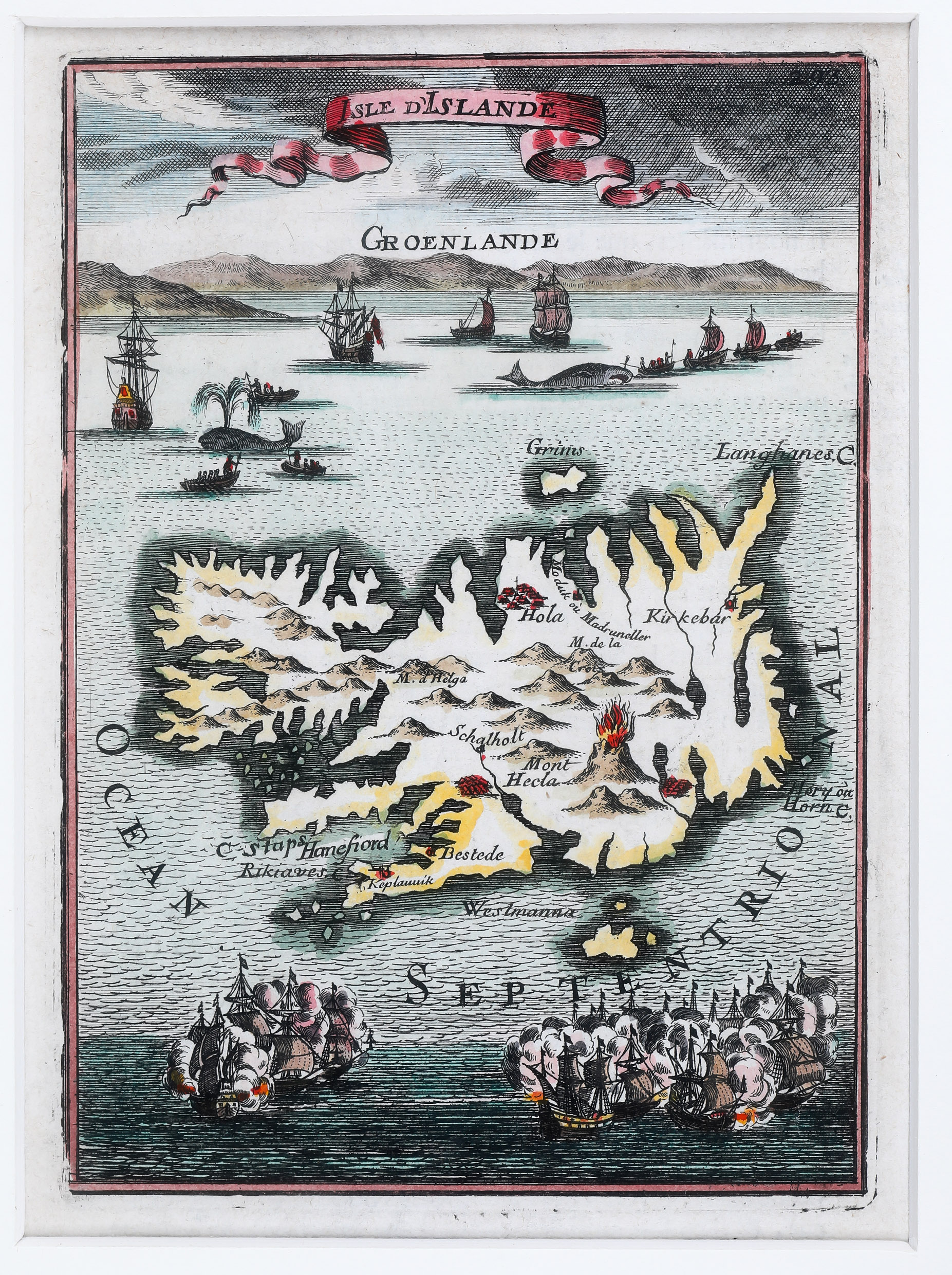
The title of this miniature map is printed in a winding banner on top of the sheet. Underneath is a profile view of Greenland which shows mountains in the background. In the ocean between Greenland and Iceland several whaling vessels are hunting and harpooning large whales from small boats and at the bottom two armies are fighting a sea battle.
In the interior of Iceland there are only a few place-names, including „Rikiaves“ (Reykjavik?), „Koplavnik“ (Kopavogur?), „Bestede“ (Bessastadir?) and the bishoprics „Schalholt“ (Skalholt) and „Hola“ (Holar). Also lots of volcanic cones are depicted. „Mont Hecla“ (Hekla) is shown erupting vigorously and this stunning depiction is probably the first stand-alone picture of that famous volcano, according to Haraldur Sigurdsson, Kortasaga Islands, 1978.