
Claude Buffier (1661 – 1737)
was a Jesuit theologian and geographer, born in Poland of French parents. He worked in Paris and his main opus „Geographie Universelle“ was issued in 1715 as a pocket-sized volume, illustrated with a set of maps which proved very popular. Therefore also after his death numerous editions were published in Paris, Naples and Rome.
Map details
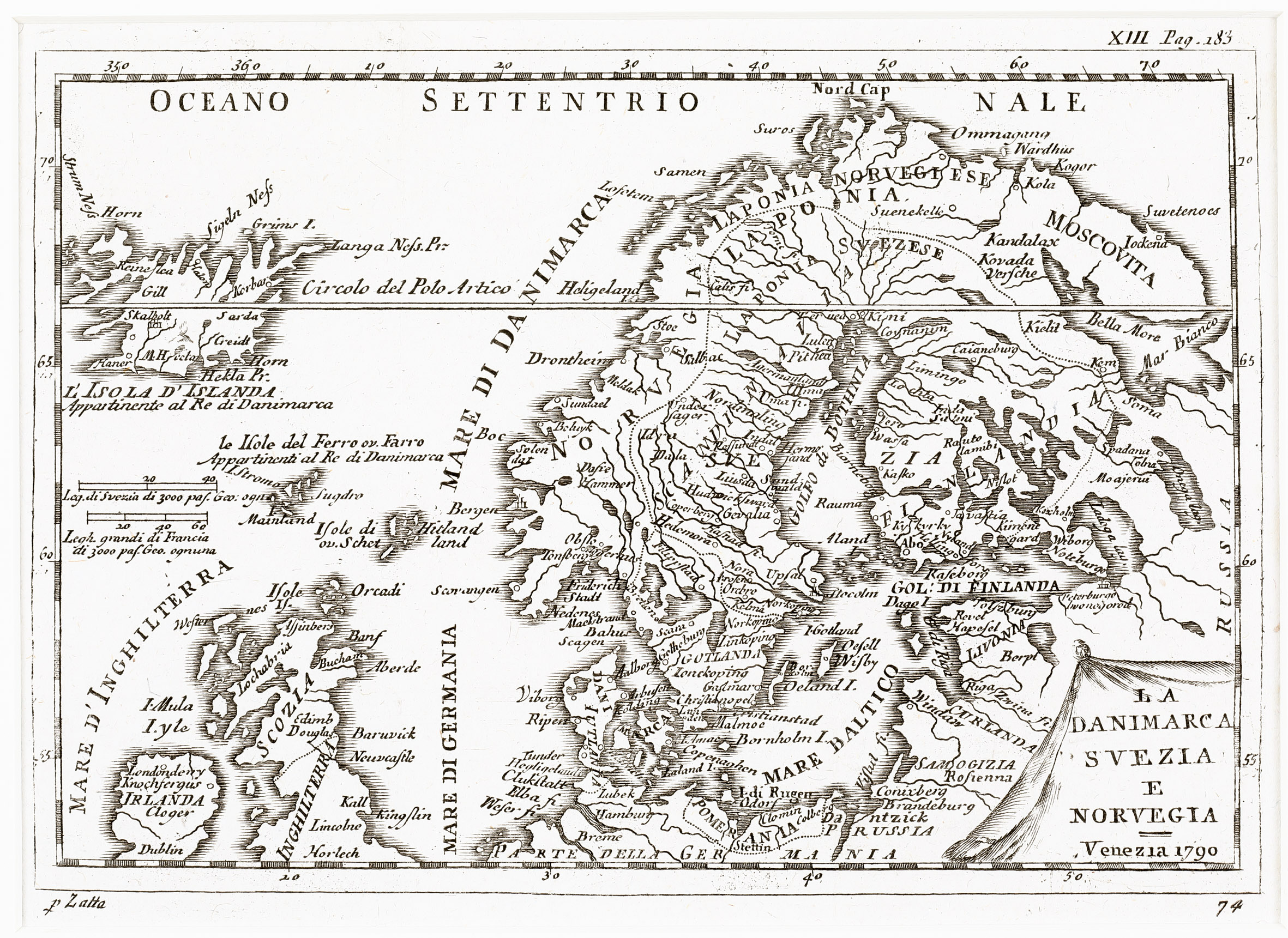
This uncommon map is from the Italian edition of Claude Buffier‘s „Geographie Universelle“, published by Antonio Zatta in 1790 (who is mentioned underneath the map on the left).
It is decorated with an unusually shaped title cartouche in the lower right corner.
„L‘Isola D‘Islanda“ is drawn to scale in the upper left corner, together with the notice underneath: „Appartinente al Re di Danimarcia“ (Property of the King of Denmark“).
In the North Atlantic two distance scales are depicted.
The map covers Scandinavia, the Baltic, Iceland, the Faroe, Shetland and Orkney Islands, Ireland, Scotland, most of England and the northern part of Germany.
In the interior of Iceland there are only a few place-names: the bishoprics Skalholt and Holar („Halon“) and „M. Hecla“. A main error is the positioning of the Arctic Circle („Circolo del Polo Artico“), placed in the center of Iceland.
This map of 1790 resembles a map of an anonymous author wich appeared c. 1720.
In the earlier map the title in the cartouche is longer and without a year specification; furthermore ornamental emblems of countries and regions are flanking the map and therefore the size of that map is larger.