
Nicolas Bion (1652 – 1733)
was a French engineer and cosmographer in Paris who became „L’ Ingenieur de Louis XIV“. He was famous for his book on the construction and principal uses of mathematical instruments, published in French language in 1709 and translated into English in 1723. Bion also constructed globes and in 1699 his book „L’ Usage des Globes Celestes et Terrestres et des Spheres, suivant les differents systemes du Monde“ was published. Besides his publications nothing is known about his life.
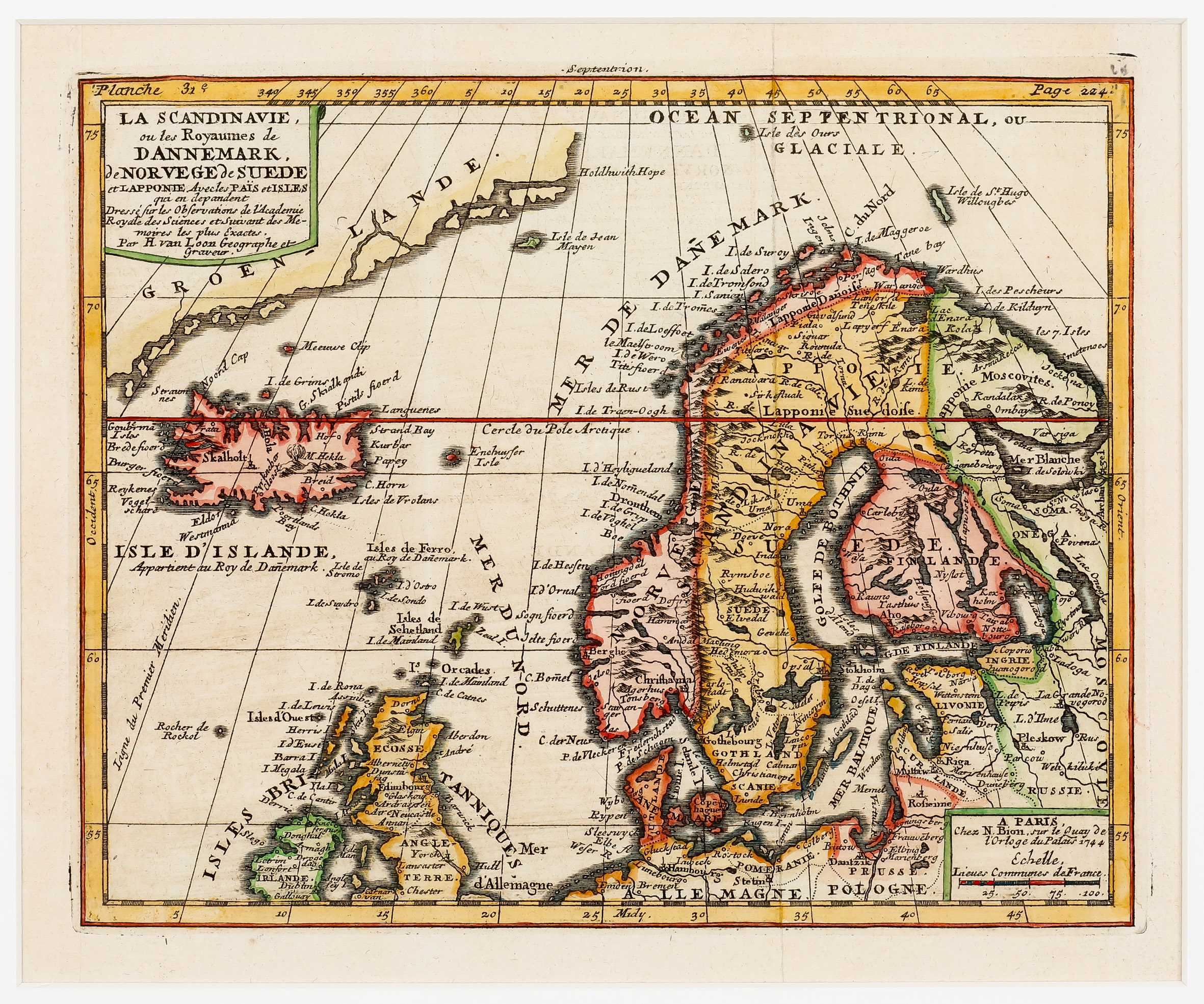
Map details
This very rare map has a title cartouche in the upper left corner mentioning H. van Loon as geographer and engraver. In the lower right corner there is a text titled „A Paris“ and underneath: Chez N. Bion, sur le Quay de l‘ Orloge du Palais 1944“. This year specification is astonishing as Bion had already passed away 11 years earlier. Underneath is an „Echelle“ (scale).
The map shows not only Scandinavia and the Baltic Region but also the southeast coast of Greenland, Iceland, the Orkney, Shetland and Faroe Islands.
The southern part of Britain and Ireland and the northern parts of Germany and Poland are cutoff. Even the small Arctic islands Jan Mayen („Isle de Jean Myyen“), the Bear Island („Isle des Ours“), the mysterious islands („Isle de St Hugo Willenbar“) north-east of the North Cape in the Barents Sea and „Enckhuysen“ are depicted. The Arctic circle runs a bit too far south.
The map of Iceland contains only poor information. There are some place-names along the coastline, but only three in the interior of the island: besides the bishoprics Skalholt and Holar an erupting „M. Hekla“ is depicted. Underneath the map of Iceland is the text: „Isle D‘Islande Appartient au Roy de Danemark“ (Iceland is a property of the King of Denmark“).