
Francois (Francesco) Santini (c. 1729 – 1793) & Guiseppe Remondini (1745 – 1811)
Francois (Francesco) Santini was a cartographer and publisher based in Venice who re-issued the works of Gilles and Didier Robert de Vaugondy, Homann Heirs and Guillaume De L’Isle.
Giuseppe Remondini collaborated with Santini who gives credit to him on most of his maps. Giuseppe was the descendant of a well-known family of printers which was founded by Giovanni Antonio Remondini (1634 – 1711) and closed not before 1860.
Map details
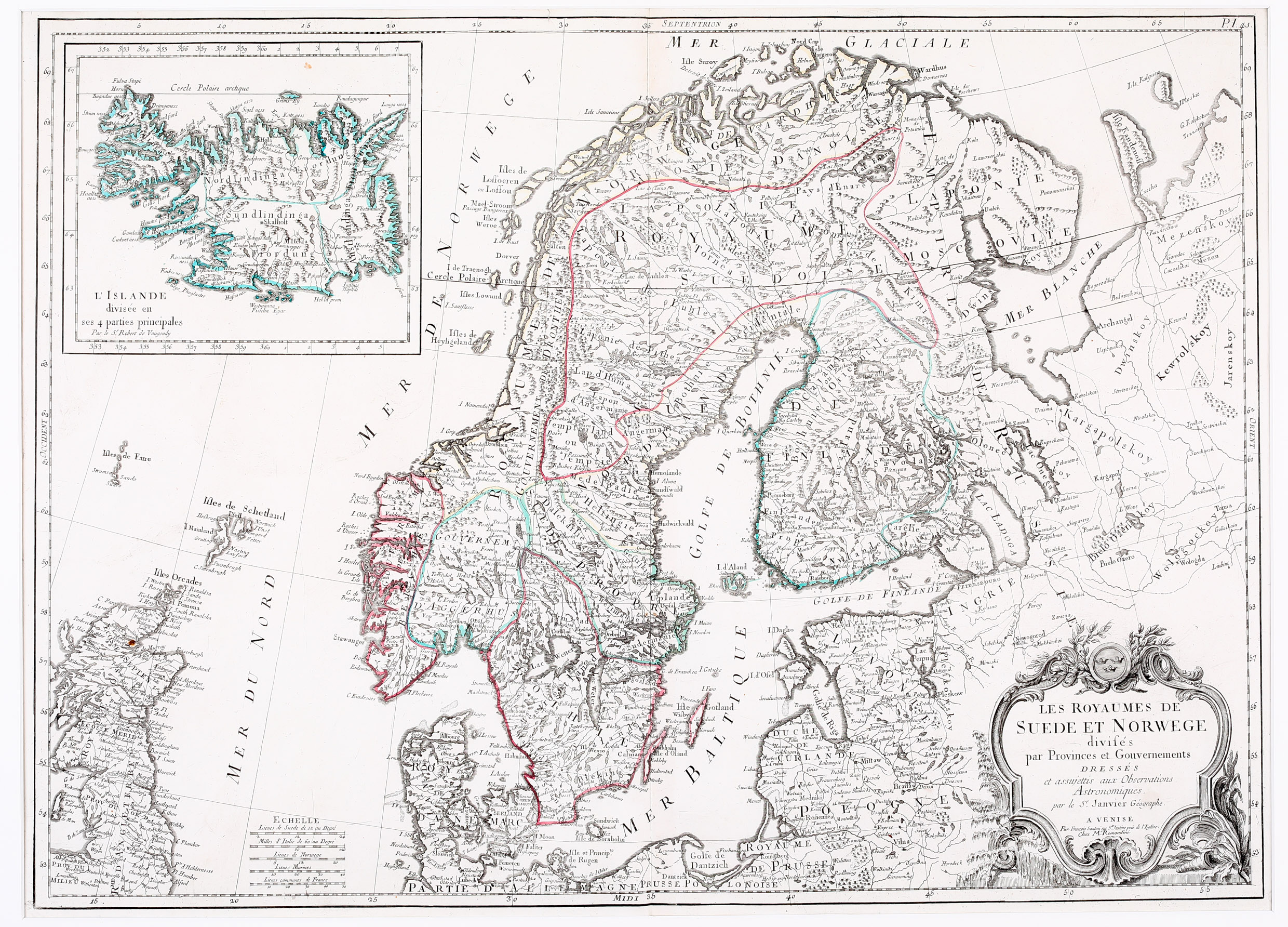
Les Royaumes de Suede et de Norwege
divises par Provinces et Gouvernements dresses et assujettis aux observations Astronomiques. Par le Sr. Janvier Geographe. Venise
This detailed map was first published in Santini‘s „Atlas Universel dresses sur les meillures cartes modernes 1776“ which contained numerous maps after Gilles and Didier Vaugondy, Jacques Nicolas Bellin, Jean Denis Janvier and others and it covers Scandinavia, the Baltic and the western part of Russia including the Faroe, Shetland and Orkney Islands and Scotland, with an inset of Iceland in the upper left corner. Five distance scales („Echelle“) are placed in the „Mer du Nord“. The decorative title in the lower right corner contains a supplement:
„Par Francois Santini, rue S‘t Justine pres l‘Eglise
Chez Mr. Remondini“.
The large inset of Iceland is entilitled: „L‘Islande divisee en ses 4 parties principales“ and names Robert de Vaugondy as the author. The map is rather detailed. Along the coastlines numerous fjords and harbours are named. In the interior the mountains, the rivers, lakes and forests are well drawn but there are only a few place-names, including the bishoprics Skalholt and Holar as well as the volcano Hekla. The Arctic Circle is marked nearly correctly running through Grimsey, only a lit bit too much south by crossing the northernmost tip of the westfjords.
Comments by the collector
In 1784 Santini sold the plates to M. Remondini, whose name appears on this particular example – indicating that this is the second state of the map.