
Herman Moll (1654 – 1732)
was an important map publisher and engraver based in London. Most likely he was a German from Bremen who moved to London in 1678. First Moll worked as an engraver for Moses Pitt on the production of the „English Atlas“. Around the turn of the century Moll set up his own business. Most of Moll‘s maps, covering all parts of the world, were produced as loose sheets that would be bound to order, however, he also published several important atlases late in his career: the „Atlas Manuale“ (1709), the „Atlas Geographus“ in five volumes (1711-7), the „New and Complete Atlas“ (1719) and the „Atlas Minor“ (1729). After Moll‘s death the Bowles family (1714 – 1832) took over possession of his stock. Due to his popularity and the sheer volume of his work, Moll‘s maps continued to dominate the British market for decades.
Map details
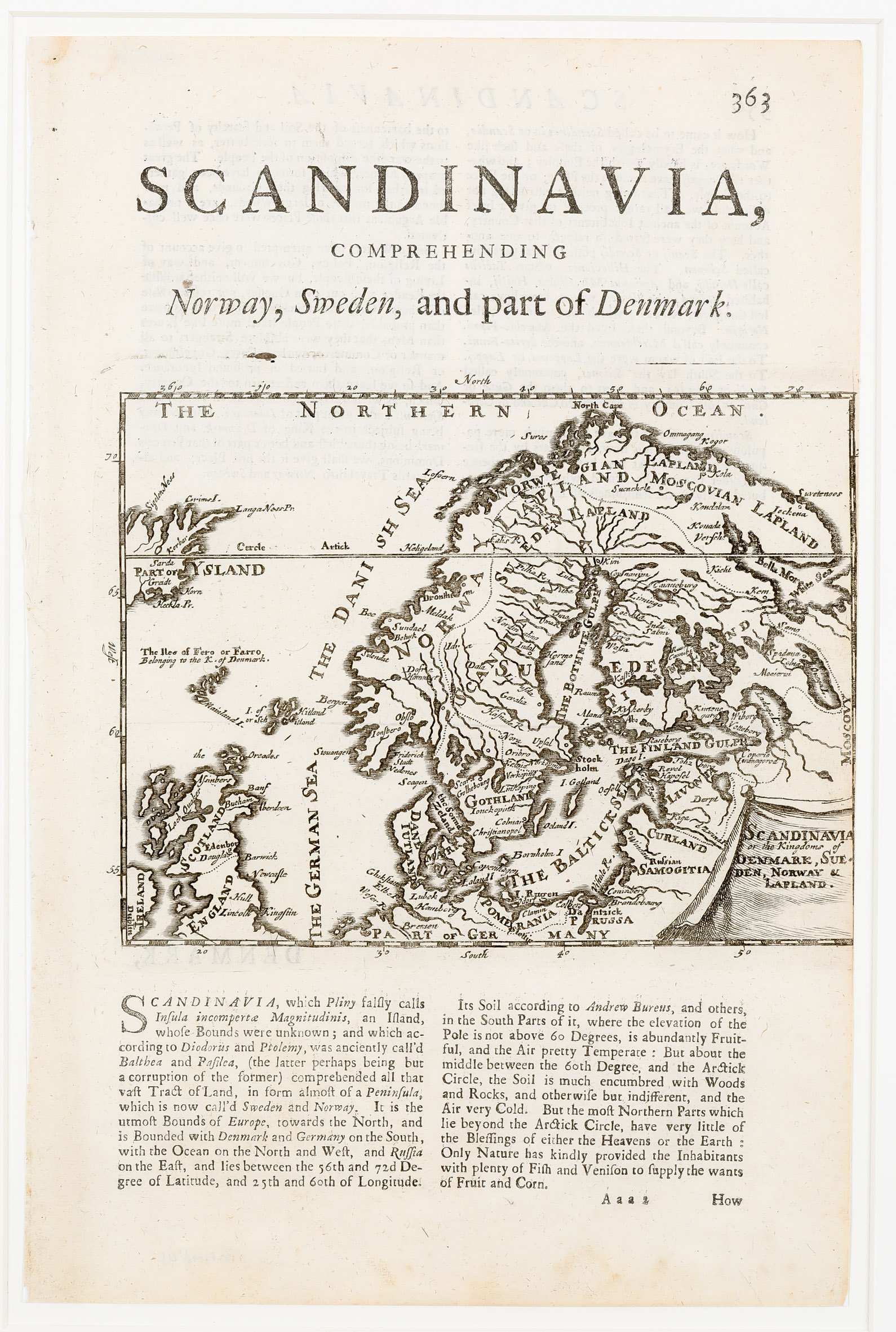
This uncommon sheet with a map of Scandinavia, the Baltic Region with Faroe Island and parts of Scotland and Iceland was published in „Atlas Manuale: Or, A New Sett of Maps Of all the Parts of the Earth, as well …“ (1723). The title is in an unusual cartouche in the lower right corner. The map shows Scandinavia, the Baltic, „Moscovy“, „Part of Germany“, the Faroe, Shetland and Orkney Islands, parts of Scotland and Ireland as well as a „Part of Ysland“ which is drawn to scale. The Arctic Circle is marked too far south.
The map of Iceland in the Joris Carolus style shows only the „right half“ of the country. The few place-names are „Grims I“, „SigelenNess“ and „LangaNessPn“ in the North, „Horn“ and „Heckla.Pr.“ in the South East and „Korbar“ and „SardaGreidt“ above and underneath the Arctic Circle Line.
Comments by the collector
This map was in a lot at an auction of Stockholms Auktionsverk and not my main target. Though only half of Iceland is to be seen I thought it worth to be included in the „Schulte Collection“, all the more the map is described shortly in islandskort.is