
Abraham Ortelius (1527 – 1598) & Johannes Baptista Vrients (1552 – 1612)
Abraham Ortelius was a Flemish/Dutch mapmaker and is perhaps the best known and most frequently collected of all sixteenth-century mapmakers. He was born in Antwerp which was then in the Habsburg Netherlands (now Belgium). The „Ortellius“ family was originally from Augsburg/Germany, a Free Imperial City of the Holy Roman Empire. Abraham started his career as a map engraver. In 1547 he entered the Antwerp Guild of Saint Luke as „afsetter van Karten“ (illuminator of maps) and became a business man dealing with books, prints and maps. He travelled a lot and at the Frankfurt book and print fair he met Gerardus Mercator in 1554. Due to his influence Ortelius seems to have been attracted towards the career of a scientific geographer. In 1564 Ortelius published his first map „Typus Orbis Terrarum“, an eight-leaved wall map of the world and in 1570 the Atlas „Theatrum Orbis Terrarum“ (Theatre of the World) with 53 maps. „The publication of this atlas marked an epoch in the history of cartography. It was the first uniformly sized, systematic collection of maps of the countries of the world based on contemporary knowledge and in that sense may be called the first modern atlas“ (Tooley, Maps and Mapmakers). In 1573 Ortelius started editing supplementary maps under the title „Addimentum Theatri Orbis Terrarum“. In 1575 he was appointed geographer to the King of Spain, Philipp II.
By the time of his death in 1598, a total of 25 editions were published including editions in Latin, Italian, German, French and Dutch; later editions were issued in Spanish and English by Ortelius‘ successors Galle and Vrients. Over the decades the atlas has tripled in size. The final edition was published in 1612.
Also remarkable about Ortelius is that he has been the first to underline a similarity between the coasts of America and Europe-Africa and to propose continental drift as an explanation.
Abraham Ortelius is often considered as the father of the Golden Age of the Dutch cartography. His death and burial in the St. Michael‘s Abbey in Antwerp were marked by public mourning. The inscription on his tombstone reads: „Quietis cultor sine lite, uxore, prole“ (Served quietly, without accusation, wife, and offspring).
Johannes Baptista Vrients, known under numerous different names was an established Antwerp publisher. In 1600 he acquired the plates of the „Epitome“ and subsequently the plates of the „Theatrum“, too. In 1601 Vrients published the new version of the „Epitome“. The maps are mostly similar to those of Ortelius & Galle of 1598 but remade with minor changes.
Mega Zoom & Pan Image Zoomer image with id 128-final does not exist!
Mega Zoom & Pan Image Zoomer image with id 128-final does not exist!
Map details
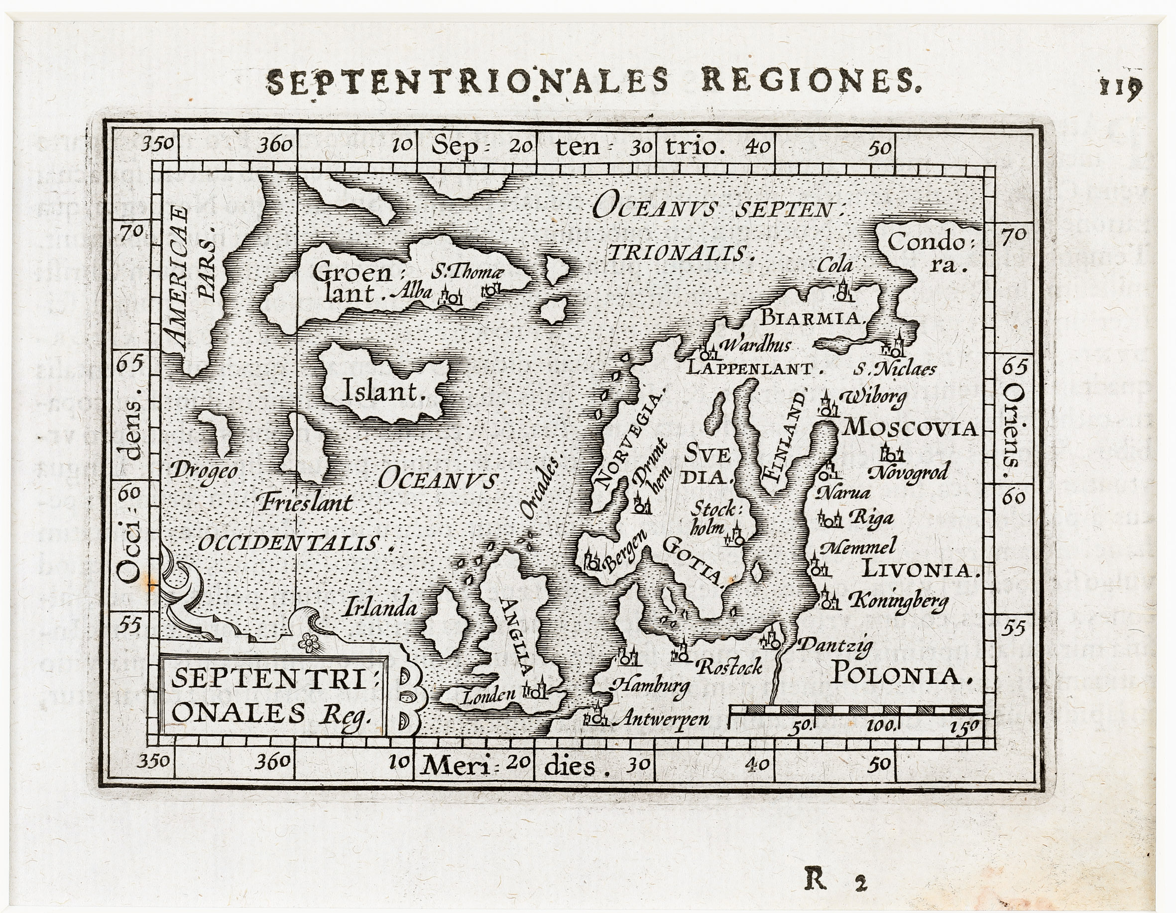
This miniature map is from the Latin edition of Ortelius‘ „Epitome“, published by Vrients in Antwerp 1609 and covers Northern Europe including Greenland („Groenlant“), Iceland („Islant“), the island „Nova Semla“, the mythical islands „Frieslant“ and „Drogeo“, a part of Northern America („Americae Pars“) in the west and of Western Russia in the east.
The title cartouche is placed in the lower left corner with an abbreviation („reg.“) while the full title is above the map. Besides its name the interior of Iceland is completely empty.